You are here: Home > Network List > TA - USArray Transportable Network (new EarthScope stations) Stations List
> Station G05D Wamic, OR, USA > Earthquake Result Viewer
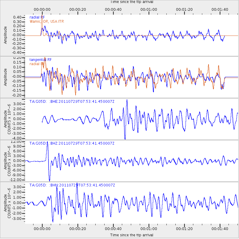
G05D Wamic, OR, USA - Earthquake Result Viewer
*The percent match for this event was below the threshold and hence no stack was calculated.
| Earthquake location: |
South Of Fiji Islands |
| Earthquake latitude/longitude: |
-23.8/179.8 |
| Earthquake time(UTC): |
2011/07/29 (210) 07:42:22 GMT |
| Earthquake Depth: |
523 km |
| Earthquake Magnitude: |
6.2 MB, 6.7 MW, 6.7 MW |
| Earthquake Catalog/Contributor: |
WHDF/NEIC |
|
| Network: |
TA USArray Transportable Network (new EarthScope stations) |
| Station: |
G05D Wamic, OR, USA |
| Lat/Lon: |
45.24 N/121.32 W |
| Elevation: |
592 m |
|
| Distance: |
87.1 deg |
| Az: |
37.291 deg |
| Baz: |
231.775 deg |
| Ray Param: |
$rayparam |
*The percent match for this event was below the threshold and hence was not used in the summary stack. |
|
| Radial Match: |
66.17264 % |
| Radial Bump: |
400 |
| Transverse Match: |
65.50755 % |
| Transverse Bump: |
373 |
| SOD ConfigId: |
405110 |
| Insert Time: |
2011-12-29 10:07:12.729 +0000 |
| GWidth: |
2.5 |
| Max Bumps: |
400 |
| Tol: |
0.001 |
|
Signal To Noise
| Channel | StoN | STA | LTA |
| TA:G05D: :BHZ:20110729T07:53:41.450007Z | 15.5371065 | 6.053215E-6 | 3.8959732E-7 |
| TA:G05D: :BHN:20110729T07:53:41.450007Z | 1.2870439 | 7.047608E-7 | 5.47581E-7 |
| TA:G05D: :BHE:20110729T07:53:41.450007Z | 2.1057062 | 8.095778E-7 | 3.8446854E-7 |
| Arrivals |
| Ps | |
| PpPs | |
| PsPs/PpSs | |


