You are here: Home > Network List > TA - USArray Transportable Network (new EarthScope stations) Stations List
> Station 933A Laredo, TX, USA > Earthquake Result Viewer
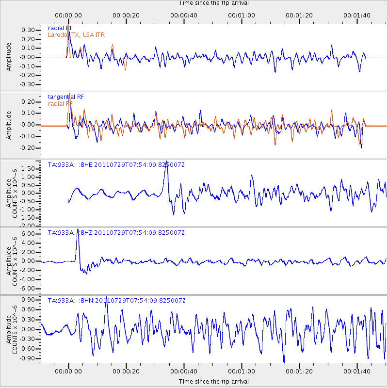
933A Laredo, TX, USA - Earthquake Result Viewer
*The percent match for this event was below the threshold and hence no stack was calculated.
| Earthquake location: |
South Of Fiji Islands |
| Earthquake latitude/longitude: |
-23.8/179.8 |
| Earthquake time(UTC): |
2011/07/29 (210) 07:42:22 GMT |
| Earthquake Depth: |
523 km |
| Earthquake Magnitude: |
6.2 MB, 6.7 MW, 6.7 MW |
| Earthquake Catalog/Contributor: |
WHDF/NEIC |
|
| Network: |
TA USArray Transportable Network (new EarthScope stations) |
| Station: |
933A Laredo, TX, USA |
| Lat/Lon: |
27.61 N/99.27 W |
| Elevation: |
214 m |
|
| Distance: |
93.3 deg |
| Az: |
61.378 deg |
| Baz: |
244.984 deg |
| Ray Param: |
$rayparam |
*The percent match for this event was below the threshold and hence was not used in the summary stack. |
|
| Radial Match: |
68.28261 % |
| Radial Bump: |
336 |
| Transverse Match: |
70.686066 % |
| Transverse Bump: |
400 |
| SOD ConfigId: |
405110 |
| Insert Time: |
2011-12-29 10:10:38.571 +0000 |
| GWidth: |
2.5 |
| Max Bumps: |
400 |
| Tol: |
0.001 |
|
Signal To Noise
| Channel | StoN | STA | LTA |
| TA:933A: :BHZ:20110729T07:54:09.825007Z | 19.532032 | 2.578001E-6 | 1.3198836E-7 |
| TA:933A: :BHN:20110729T07:54:09.825007Z | 1.4561043 | 2.1601427E-7 | 1.4835082E-7 |
| TA:933A: :BHE:20110729T07:54:09.825007Z | 4.3786626 | 8.35654E-7 | 1.9084686E-7 |
| Arrivals |
| Ps | |
| PpPs | |
| PsPs/PpSs | |


