You are here: Home > Network List > TA - USArray Transportable Network (new EarthScope stations) Stations List
> Station L04D Klamath Falls, OR, USA > Earthquake Result Viewer
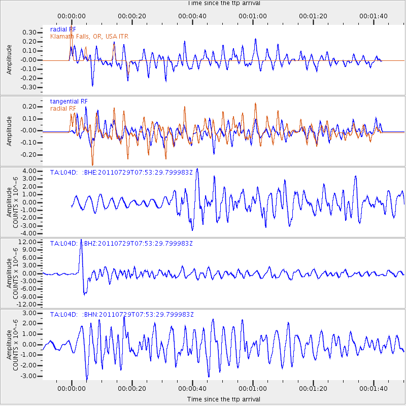
L04D Klamath Falls, OR, USA - Earthquake Result Viewer
*The percent match for this event was below the threshold and hence no stack was calculated.
| Earthquake location: |
South Of Fiji Islands |
| Earthquake latitude/longitude: |
-23.8/179.8 |
| Earthquake time(UTC): |
2011/07/29 (210) 07:42:22 GMT |
| Earthquake Depth: |
523 km |
| Earthquake Magnitude: |
6.2 MB, 6.7 MW, 6.7 MW |
| Earthquake Catalog/Contributor: |
WHDF/NEIC |
|
| Network: |
TA USArray Transportable Network (new EarthScope stations) |
| Station: |
L04D Klamath Falls, OR, USA |
| Lat/Lon: |
42.22 N/122.30 W |
| Elevation: |
1437 m |
|
| Distance: |
84.7 deg |
| Az: |
39.216 deg |
| Baz: |
231.232 deg |
| Ray Param: |
$rayparam |
*The percent match for this event was below the threshold and hence was not used in the summary stack. |
|
| Radial Match: |
75.54606 % |
| Radial Bump: |
400 |
| Transverse Match: |
64.22068 % |
| Transverse Bump: |
400 |
| SOD ConfigId: |
405110 |
| Insert Time: |
2011-12-29 10:11:54.991 +0000 |
| GWidth: |
2.5 |
| Max Bumps: |
400 |
| Tol: |
0.001 |
|
Signal To Noise
| Channel | StoN | STA | LTA |
| TA:L04D: :BHZ:20110729T07:53:29.799983Z | 12.631538 | 5.3162844E-6 | 4.2087387E-7 |
| TA:L04D: :BHN:20110729T07:53:29.799983Z | 3.5920773 | 1.0739453E-6 | 2.9897615E-7 |
| TA:L04D: :BHE:20110729T07:53:29.799983Z | 1.3751844 | 7.5370576E-7 | 5.480761E-7 |
| Arrivals |
| Ps | |
| PpPs | |
| PsPs/PpSs | |


