You are here: Home > Network List > TA - USArray Transportable Network (new EarthScope stations) Stations List
> Station C06D Leavenworth, WQ, USA > Earthquake Result Viewer
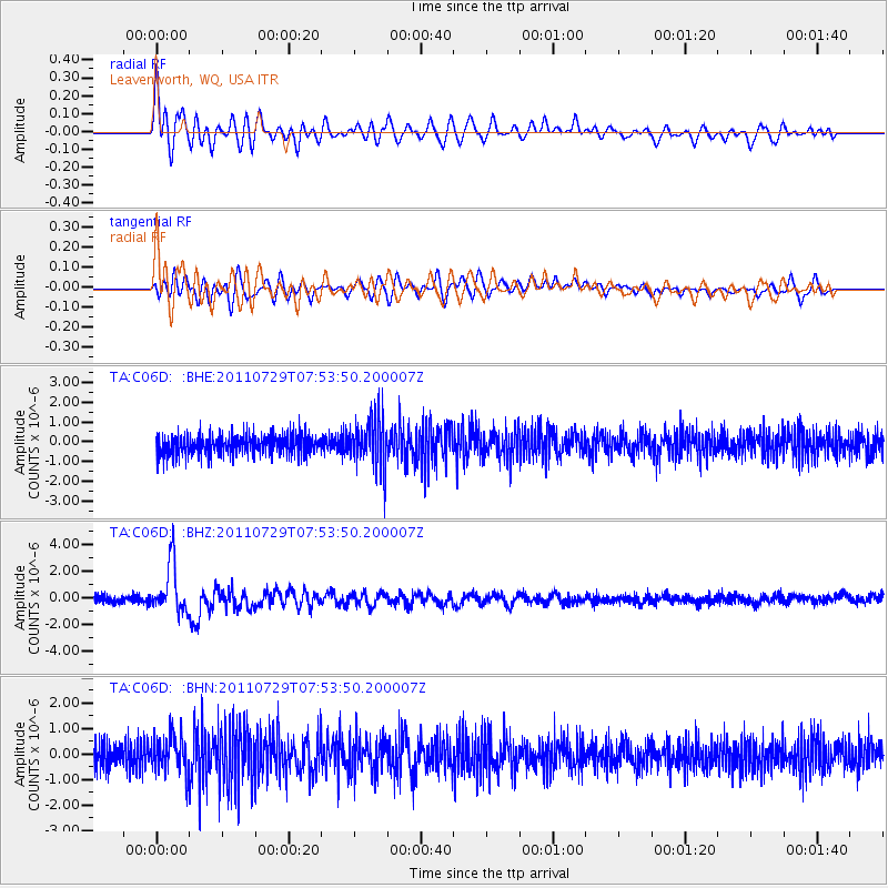
C06D Leavenworth, WQ, USA - Earthquake Result Viewer
*The percent match for this event was below the threshold and hence no stack was calculated.
| Earthquake location: |
South Of Fiji Islands |
| Earthquake latitude/longitude: |
-23.8/179.8 |
| Earthquake time(UTC): |
2011/07/29 (210) 07:42:22 GMT |
| Earthquake Depth: |
523 km |
| Earthquake Magnitude: |
6.2 MB, 6.7 MW, 6.7 MW |
| Earthquake Catalog/Contributor: |
WHDF/NEIC |
|
| Network: |
TA USArray Transportable Network (new EarthScope stations) |
| Station: |
C06D Leavenworth, WQ, USA |
| Lat/Lon: |
47.92 N/120.89 W |
| Elevation: |
544 m |
|
| Distance: |
89.0 deg |
| Az: |
35.359 deg |
| Baz: |
232.015 deg |
| Ray Param: |
$rayparam |
*The percent match for this event was below the threshold and hence was not used in the summary stack. |
|
| Radial Match: |
71.107796 % |
| Radial Bump: |
400 |
| Transverse Match: |
62.373215 % |
| Transverse Bump: |
400 |
| SOD ConfigId: |
405110 |
| Insert Time: |
2011-12-29 10:13:44.428 +0000 |
| GWidth: |
2.5 |
| Max Bumps: |
400 |
| Tol: |
0.001 |
|
Signal To Noise
| Channel | StoN | STA | LTA |
| TA:C06D: :BHZ:20110729T07:53:50.200007Z | 7.5829625 | 1.8619353E-6 | 2.4554194E-7 |
| TA:C06D: :BHN:20110729T07:53:50.200007Z | 1.5307105 | 7.223047E-7 | 4.7187547E-7 |
| TA:C06D: :BHE:20110729T07:53:50.200007Z | 2.5296376 | 1.2668047E-6 | 5.0078506E-7 |
| Arrivals |
| Ps | |
| PpPs | |
| PsPs/PpSs | |


