You are here: Home > Network List > UW - Pacific Northwest Regional Seismic Network Stations List
> Station DAVN Chrisman Ranch, Davenport, WA, USA > Earthquake Result Viewer
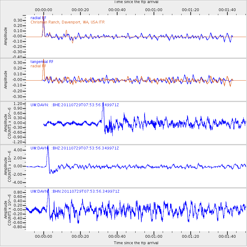
DAVN Chrisman Ranch, Davenport, WA, USA - Earthquake Result Viewer
*The percent match for this event was below the threshold and hence no stack was calculated.
| Earthquake location: |
South Of Fiji Islands |
| Earthquake latitude/longitude: |
-23.8/179.8 |
| Earthquake time(UTC): |
2011/07/29 (210) 07:42:22 GMT |
| Earthquake Depth: |
523 km |
| Earthquake Magnitude: |
6.2 MB, 6.7 MW, 6.7 MW |
| Earthquake Catalog/Contributor: |
WHDF/NEIC |
|
| Network: |
UW Pacific Northwest Regional Seismic Network |
| Station: |
DAVN Chrisman Ranch, Davenport, WA, USA |
| Lat/Lon: |
47.80 N/118.27 W |
| Elevation: |
495 m |
|
| Distance: |
90.3 deg |
| Az: |
36.519 deg |
| Baz: |
233.959 deg |
| Ray Param: |
$rayparam |
*The percent match for this event was below the threshold and hence was not used in the summary stack. |
|
| Radial Match: |
78.10818 % |
| Radial Bump: |
400 |
| Transverse Match: |
57.888668 % |
| Transverse Bump: |
400 |
| SOD ConfigId: |
405110 |
| Insert Time: |
2011-12-29 10:17:09.411 +0000 |
| GWidth: |
2.5 |
| Max Bumps: |
400 |
| Tol: |
0.001 |
|
Signal To Noise
| Channel | StoN | STA | LTA |
| UW:DAVN: :BHZ:20110729T07:53:56.349971Z | 28.512613 | 1.8057957E-6 | 6.3333225E-8 |
| UW:DAVN: :BHN:20110729T07:53:56.349971Z | 6.020816 | 3.7561128E-7 | 6.2385446E-8 |
| UW:DAVN: :BHE:20110729T07:53:56.349971Z | 7.2633977 | 4.970043E-7 | 6.842587E-8 |
| Arrivals |
| Ps | |
| PpPs | |
| PsPs/PpSs | |


