
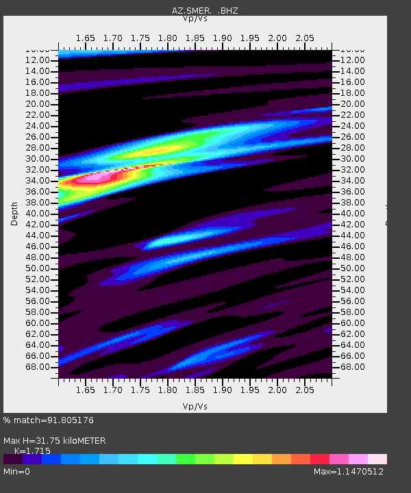
SMER AZ.SMER - Earthquake Result Viewer
| ||||||||||||||||||
| ||||||||||||||||||
| ||||||||||||||||||
|
Signal To Noise
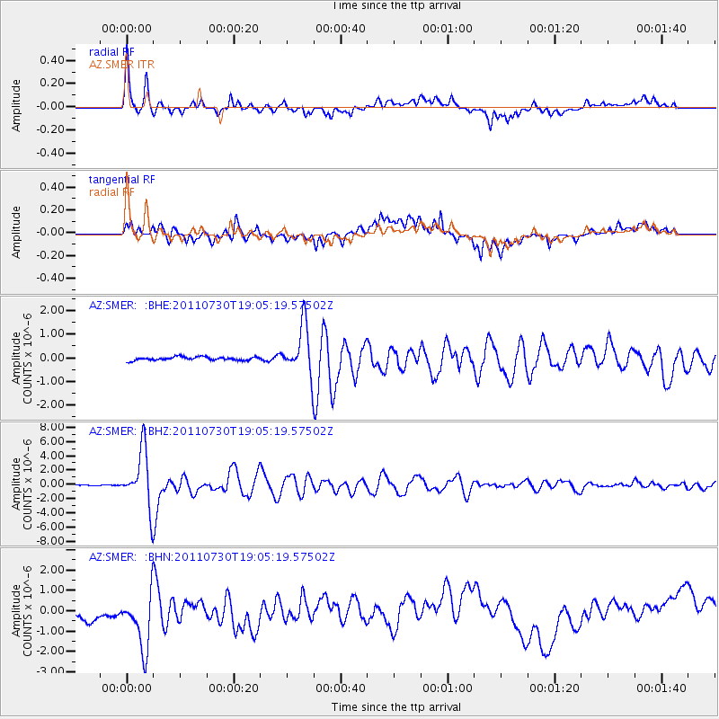
| Channel | StoN | STA | LTA |
| AZ:SMER: :BHZ:20110730T19:05:19.57502Z | 59.439896 | 4.0375066E-6 | 6.792587E-8 |
| AZ:SMER: :BHN:20110730T19:05:19.57502Z | 4.5778804 | 1.5011025E-6 | 3.2790336E-7 |
| AZ:SMER: :BHE:20110730T19:05:19.57502Z | 14.2449255 | 1.0546198E-6 | 7.403477E-8 |
| Arrivals | |
| Ps | 3.7 SECOND |
| PpPs | 13 SECOND |
| PsPs/PpSs | 17 SECOND |

