CMB Columbia College, Columbia, CA - Earthquake Result Viewer
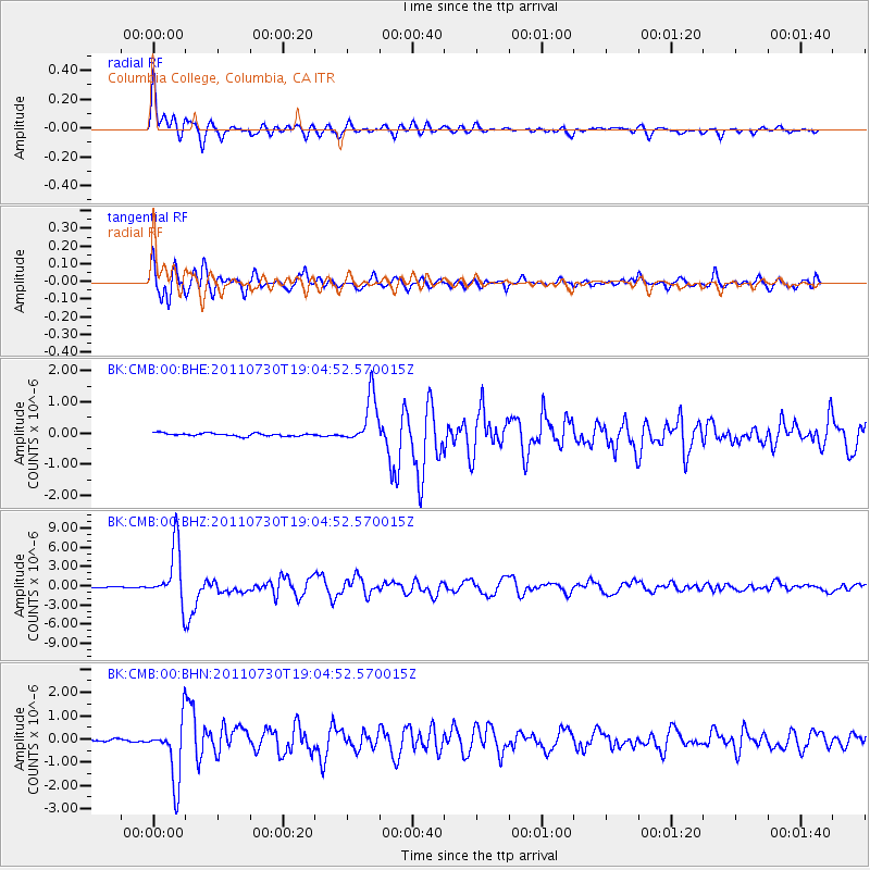
Earthquake location: Near East Coast Of Honshu, Japan
Earthquake latitude/longitude: 36.9/141.0
Earthquake time(UTC): 2011/07/30 (211) 18:53:49 GMT
Earthquake Depth: 30 km
Earthquake Magnitude: 6.4 MB, 6.0 MS, 6.5 MW, 6.4 MW
Earthquake Catalog/Contributor: WHDF/NEIC
Network: BK Berkeley Digital Seismograph Network
Station: CMB Columbia College, Columbia, CA
Lat/Lon: 38.03 N/120.39 W
Elevation: 697 m
Distance: 74.2 deg
Az: 54.217 deg
Baz: 304.606 deg
Ray Param: 0.052440304
Estimated Moho Depth: 14.25 km
Estimated Crust Vp/Vs: 1.83
Assumed Crust Vp: 6.597 km/s
Estimated Crust Vs: 3.61 km/s
Estimated Crust Poisson's Ratio: 0.29
Radial Match: 95.76755 %
Radial Bump: 400
Transverse Match: 91.262794 %
Transverse Bump: 400
SOD ConfigId: 408116
Insert Time: 2012-01-01 00:52:53.188 +0000
GWidth: 2.5
Max Bumps: 400
Tol: 0.001

Signal To Noise

ChannelStoNSTALTA
BK:CMB:00:BHZ:20110730T19:04:52.570015Z66.246824.434978E-66.694628E-8
BK:CMB:00:BHN:20110730T19:04:52.570015Z24.9135591.3004105E-65.21969E-8
BK:CMB:00:BHE:20110730T19:04:52.570015Z16.597457.741536E-74.6642924E-8
Arrivals
Ps1.8 SECOND
PpPs5.9 SECOND
PsPs/PpSs7.8 SECOND