HUMO Hull Mountain, OR - Earthquake Result Viewer
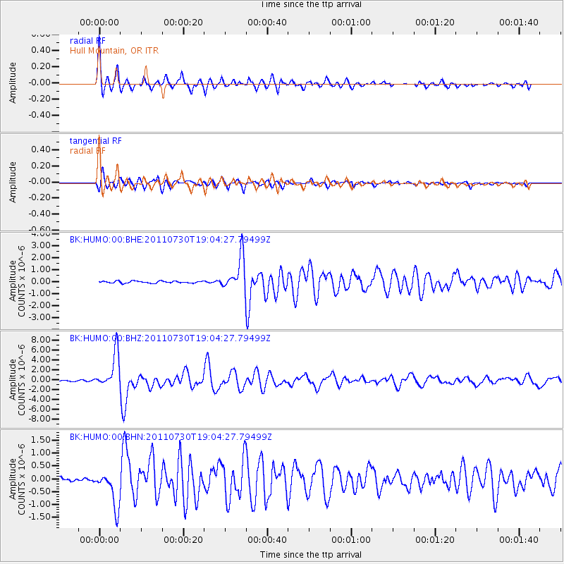
Earthquake location: Near East Coast Of Honshu, Japan
Earthquake latitude/longitude: 36.9/141.0
Earthquake time(UTC): 2011/07/30 (211) 18:53:49 GMT
Earthquake Depth: 30 km
Earthquake Magnitude: 6.4 MB, 6.0 MS, 6.5 MW, 6.4 MW
Earthquake Catalog/Contributor: WHDF/NEIC
Network: BK Berkeley Digital Seismograph Network
Station: HUMO Hull Mountain, OR
Lat/Lon: 42.61 N/122.96 W
Elevation: 555 m
Distance: 70.1 deg
Az: 51.344 deg
Baz: 302.066 deg
Ray Param: 0.05518709
Estimated Moho Depth: 65.0 km
Estimated Crust Vp/Vs: 2.04
Assumed Crust Vp: 6.522 km/s
Estimated Crust Vs: 3.201 km/s
Estimated Crust Poisson's Ratio: 0.34
Radial Match: 91.874626 %
Radial Bump: 400
Transverse Match: 86.99471 %
Transverse Bump: 400
SOD ConfigId: 408116
Insert Time: 2012-01-01 00:53:05.604 +0000
GWidth: 2.5
Max Bumps: 400
Tol: 0.001

Signal To Noise

ChannelStoNSTALTA
BK:HUMO:00:BHZ:20110730T19:04:27.79499Z31.3078353.6207603E-61.15650295E-7
BK:HUMO:00:BHN:20110730T19:04:27.79499Z7.5453357.2641444E-79.6273325E-8
BK:HUMO:00:BHE:20110730T19:04:27.79499Z17.9120851.4542236E-68.118673E-8
Arrivals
Ps11 SECOND
PpPs29 SECOND
PsPs/PpSs40 SECOND