BFS Mt Baldy Forest Station - Earthquake Result Viewer
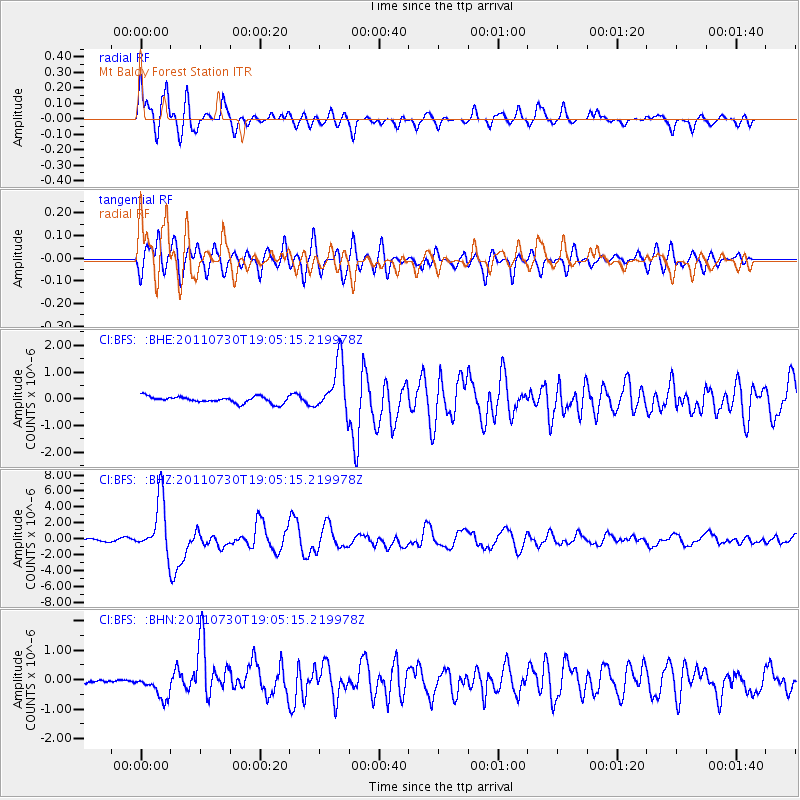
Earthquake location: Near East Coast Of Honshu, Japan
Earthquake latitude/longitude: 36.9/141.0
Earthquake time(UTC): 2011/07/30 (211) 18:53:49 GMT
Earthquake Depth: 30 km
Earthquake Magnitude: 6.4 MB, 6.0 MS, 6.5 MW, 6.4 MW
Earthquake Catalog/Contributor: WHDF/NEIC
Network: CI Caltech Regional Seismic Network
Station: BFS Mt Baldy Forest Station
Lat/Lon: 34.24 N/117.66 W
Elevation: 1312 m
Distance: 78.2 deg
Az: 56.061 deg
Baz: 306.649 deg
Ray Param: 0.049751047
Estimated Moho Depth: 31.5 km
Estimated Crust Vp/Vs: 1.83
Assumed Crust Vp: 6.276 km/s
Estimated Crust Vs: 3.434 km/s
Estimated Crust Poisson's Ratio: 0.29
Radial Match: 89.122536 %
Radial Bump: 400
Transverse Match: 82.83496 %
Transverse Bump: 400
SOD ConfigId: 408116
Insert Time: 2012-01-01 00:57:25.154 +0000
GWidth: 2.5
Max Bumps: 400
Tol: 0.001

Signal To Noise

ChannelStoNSTALTA
CI:BFS: :BHZ:20110730T19:05:15.219978Z31.8798333.450084E-61.0822152E-7
CI:BFS: :BHN:20110730T19:05:15.219978Z2.67078523.8054435E-71.4248408E-7
CI:BFS: :BHE:20110730T19:05:15.219978Z7.913079.557494E-71.2078112E-7
Arrivals
Ps4.3 SECOND
PpPs14 SECOND
PsPs/PpSs18 SECOND