MUR Murrieta - Earthquake Result Viewer
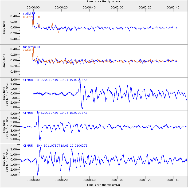
Earthquake location: Near East Coast Of Honshu, Japan
Earthquake latitude/longitude: 36.9/141.0
Earthquake time(UTC): 2011/07/30 (211) 18:53:49 GMT
Earthquake Depth: 30 km
Earthquake Magnitude: 6.4 MB, 6.0 MS, 6.5 MW, 6.4 MW
Earthquake Catalog/Contributor: WHDF/NEIC
Network: CI Caltech Regional Seismic Network
Station: MUR Murrieta
Lat/Lon: 33.60 N/117.20 W
Elevation: 562 m
Distance: 78.9 deg
Az: 56.346 deg
Baz: 306.963 deg
Ray Param: 0.049283322
Estimated Moho Depth: 26.75 km
Estimated Crust Vp/Vs: 1.74
Assumed Crust Vp: 6.264 km/s
Estimated Crust Vs: 3.6 km/s
Estimated Crust Poisson's Ratio: 0.25
Radial Match: 95.26774 %
Radial Bump: 335
Transverse Match: 85.78708 %
Transverse Bump: 400
SOD ConfigId: 408116
Insert Time: 2012-01-01 00:57:54.850 +0000
GWidth: 2.5
Max Bumps: 400
Tol: 0.001

Signal To Noise

ChannelStoNSTALTA
CI:MUR: :BHZ:20110730T19:05:19.020027Z25.1707125.012541E-61.9914181E-7
CI:MUR: :BHN:20110730T19:05:19.020027Z6.59575131.2695757E-61.9248387E-7
CI:MUR: :BHE:20110730T19:05:19.020027Z10.1156561.5234423E-61.5060242E-7
Arrivals
Ps3.3 SECOND
PpPs11 SECOND
PsPs/PpSs15 SECOND