GMR Granite Mountains Research Center - Earthquake Result Viewer
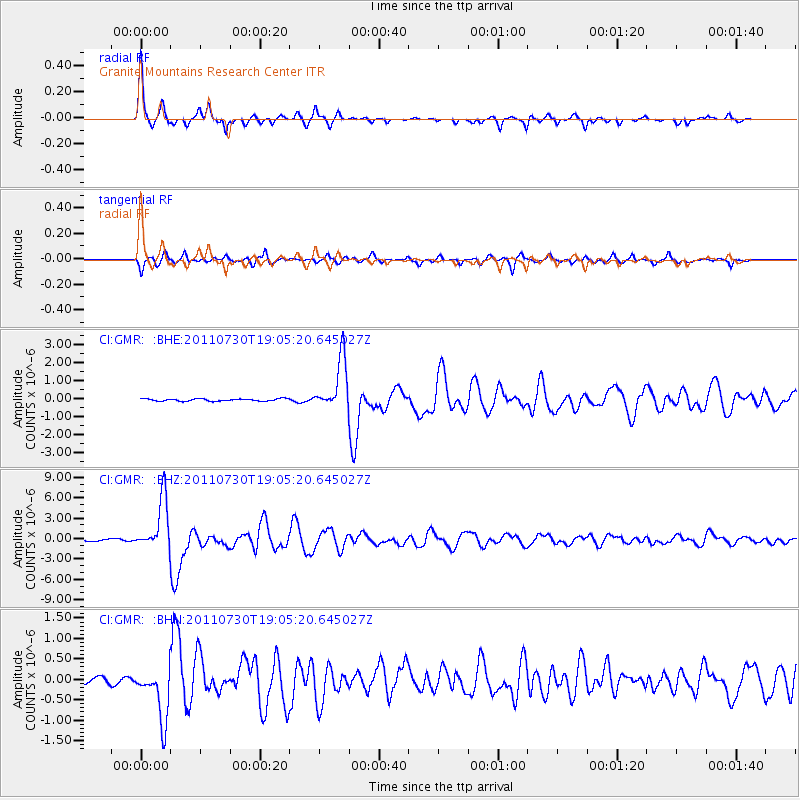
Earthquake location: Near East Coast Of Honshu, Japan
Earthquake latitude/longitude: 36.9/141.0
Earthquake time(UTC): 2011/07/30 (211) 18:53:49 GMT
Earthquake Depth: 30 km
Earthquake Magnitude: 6.4 MB, 6.0 MS, 6.5 MW, 6.4 MW
Earthquake Catalog/Contributor: WHDF/NEIC
Network: CI Caltech Regional Seismic Network
Station: GMR Granite Mountains Research Center
Lat/Lon: 34.78 N/115.66 W
Elevation: 1326 m
Distance: 79.2 deg
Az: 54.604 deg
Baz: 307.491 deg
Ray Param: 0.04907935
Estimated Moho Depth: 25.5 km
Estimated Crust Vp/Vs: 1.87
Assumed Crust Vp: 6.276 km/s
Estimated Crust Vs: 3.356 km/s
Estimated Crust Poisson's Ratio: 0.30
Radial Match: 96.9725 %
Radial Bump: 215
Transverse Match: 89.79277 %
Transverse Bump: 400
SOD ConfigId: 408116
Insert Time: 2012-01-01 00:58:02.639 +0000
GWidth: 2.5
Max Bumps: 400
Tol: 0.001

Signal To Noise

ChannelStoNSTALTA
CI:GMR: :BHZ:20110730T19:05:20.645027Z32.0563243.8092942E-61.1883128E-7
CI:GMR: :BHN:20110730T19:05:20.645027Z8.6930446.592827E-77.584026E-8
CI:GMR: :BHE:20110730T19:05:20.645027Z22.3400551.4221332E-66.365845E-8
Arrivals
Ps3.6 SECOND
PpPs11 SECOND
PsPs/PpSs15 SECOND