SLBS Sierra la Laguna Baja California Sur, Mexico - Earthquake Result Viewer
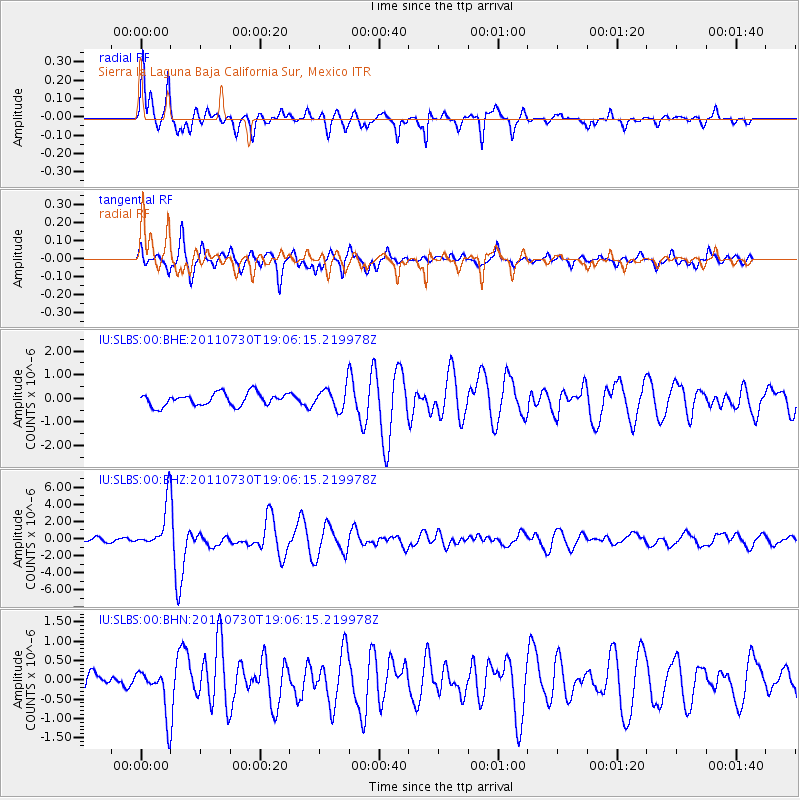
Earthquake location: Near East Coast Of Honshu, Japan
Earthquake latitude/longitude: 36.9/141.0
Earthquake time(UTC): 2011/07/30 (211) 18:53:49 GMT
Earthquake Depth: 30 km
Earthquake Magnitude: 6.4 MB, 6.0 MS, 6.5 MW, 6.4 MW
Earthquake Catalog/Contributor: WHDF/NEIC
Network: IU Global Seismograph Network (GSN - IRIS/USGS)
Station: SLBS Sierra la Laguna Baja California Sur, Mexico
Lat/Lon: 23.69 N/109.94 W
Elevation: 825 m
Distance: 90.1 deg
Az: 60.031 deg
Baz: 310.793 deg
Ray Param: 0.04169613
Estimated Moho Depth: 10.0 km
Estimated Crust Vp/Vs: 1.95
Assumed Crust Vp: 6.183 km/s
Estimated Crust Vs: 3.171 km/s
Estimated Crust Poisson's Ratio: 0.32
Radial Match: 90.154465 %
Radial Bump: 388
Transverse Match: 86.091576 %
Transverse Bump: 400
SOD ConfigId: 408116
Insert Time: 2012-01-01 01:01:04.677 +0000
GWidth: 2.5
Max Bumps: 400
Tol: 0.001

Signal To Noise

ChannelStoNSTALTA
IU:SLBS:00:BHZ:20110730T19:06:15.219978Z10.6628352.5848258E-62.4241447E-7
IU:SLBS:00:BHN:20110730T19:06:15.219978Z3.25344515.7310257E-71.7615253E-7
IU:SLBS:00:BHE:20110730T19:06:15.219978Z1.75084644.673905E-72.669512E-7
Arrivals
Ps1.6 SECOND
PpPs4.7 SECOND
PsPs/PpSs6.3 SECOND