
GRFO Grafenberg, Germany - Earthquake Result Viewer
| ||||||||||||||||||
| ||||||||||||||||||
| ||||||||||||||||||
|
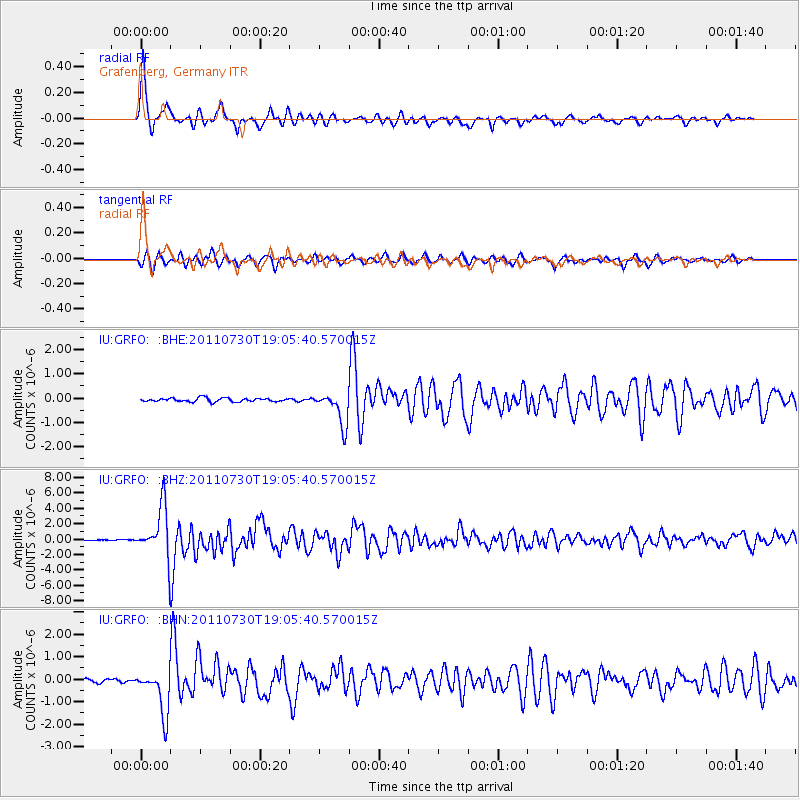
Signal To Noise
| Channel | StoN | STA | LTA |
| IU:GRFO: :BHZ:20110730T19:05:40.570015Z | 68.35336 | 3.2433206E-6 | 4.7449323E-8 |
| IU:GRFO: :BHN:20110730T19:05:40.570015Z | 15.827346 | 9.879449E-7 | 6.242012E-8 |
| IU:GRFO: :BHE:20110730T19:05:40.570015Z | 9.210487 | 6.8973463E-7 | 7.488579E-8 |
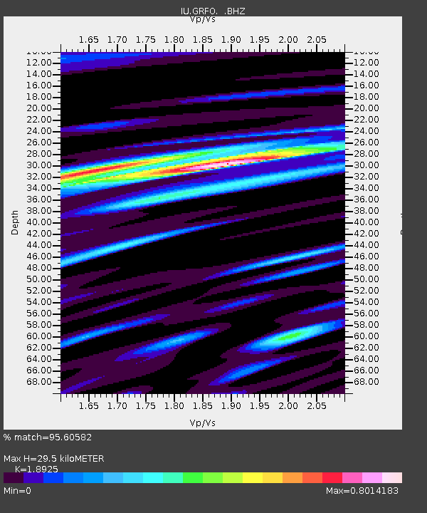
| Arrivals | |
| Ps | 4.4 SECOND |
| PpPs | 13 SECOND |
| PsPs/PpSs | 18 SECOND |

