
MDND Maddock, ND, USA - Earthquake Result Viewer
| ||||||||||||||||||
| ||||||||||||||||||
| ||||||||||||||||||
|
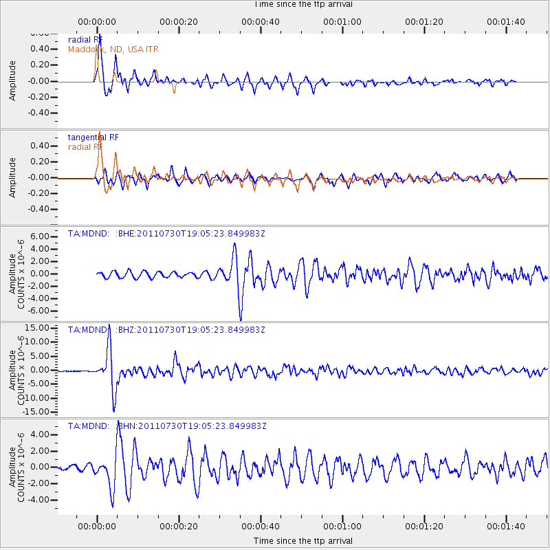
Signal To Noise
| Channel | StoN | STA | LTA |
| TA:MDND: :BHZ:20110730T19:05:23.849983Z | 64.2141 | 7.5241887E-6 | 1.1717346E-7 |
| TA:MDND: :BHN:20110730T19:05:23.849983Z | 4.286119 | 1.9507895E-6 | 4.5514125E-7 |
| TA:MDND: :BHE:20110730T19:05:23.849983Z | 5.0185785 | 2.3137302E-6 | 4.61033E-7 |
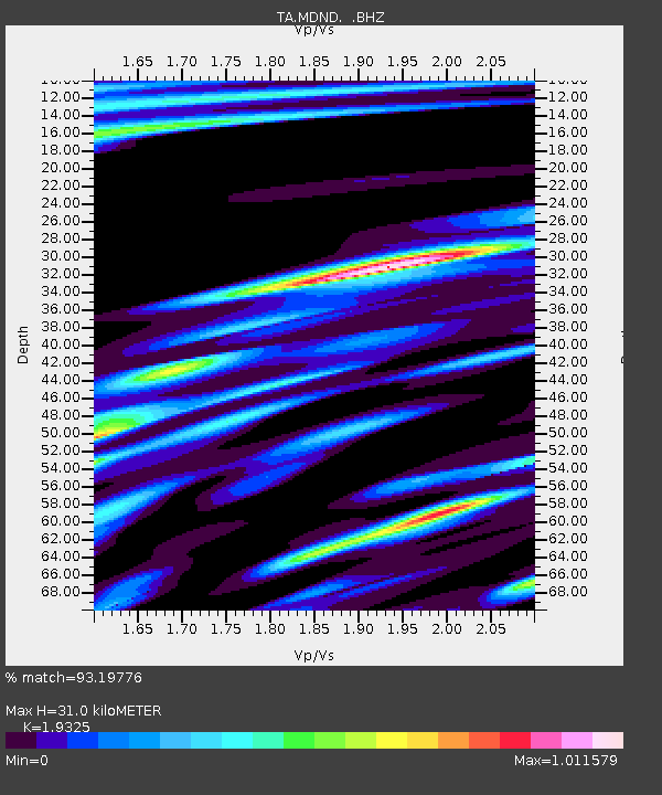
| Arrivals | |
| Ps | 4.5 SECOND |
| PpPs | 14 SECOND |
| PsPs/PpSs | 18 SECOND |

