You are here: Home > Network List > TA - USArray Transportable Network (new EarthScope stations) Stations List
> Station H25A Fruitdale, SD, USA > Earthquake Result Viewer
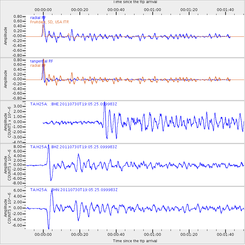
H25A Fruitdale, SD, USA - Earthquake Result Viewer
*The percent match for this event was below the threshold and hence no stack was calculated.
| Earthquake location: |
Near East Coast Of Honshu, Japan |
| Earthquake latitude/longitude: |
36.9/141.0 |
| Earthquake time(UTC): |
2011/07/30 (211) 18:53:49 GMT |
| Earthquake Depth: |
30 km |
| Earthquake Magnitude: |
6.4 MB, 6.0 MS, 6.5 MW, 6.4 MW |
| Earthquake Catalog/Contributor: |
WHDF/NEIC |
|
| Network: |
TA USArray Transportable Network (new EarthScope stations) |
| Station: |
H25A Fruitdale, SD, USA |
| Lat/Lon: |
44.62 N/103.60 W |
| Elevation: |
942 m |
|
| Distance: |
80.0 deg |
| Az: |
40.9 deg |
| Baz: |
312.73 deg |
| Ray Param: |
$rayparam |
*The percent match for this event was below the threshold and hence was not used in the summary stack. |
|
| Radial Match: |
94.03399 % |
| Radial Bump: |
400 |
| Transverse Match: |
99.21153 % |
| Transverse Bump: |
169 |
| SOD ConfigId: |
408116 |
| Insert Time: |
2012-01-01 01:09:32.853 +0000 |
| GWidth: |
2.5 |
| Max Bumps: |
400 |
| Tol: |
0.001 |
|
Signal To Noise
| Channel | StoN | STA | LTA |
| TA:H25A: :BHZ:20110730T19:05:25.099983Z | 43.415752 | 4.040015E-6 | 9.3054126E-8 |
| TA:H25A: :BHN:20110730T19:05:25.099983Z | 30.121527 | 3.3604124E-6 | 1.1156182E-7 |
| TA:H25A: :BHE:20110730T19:05:25.099983Z | 10.466251 | 1.5484452E-6 | 1.479465E-7 |
| Arrivals |
| Ps | |
| PpPs | |
| PsPs/PpSs | |


