G05D Wamic, OR, USA - Earthquake Result Viewer
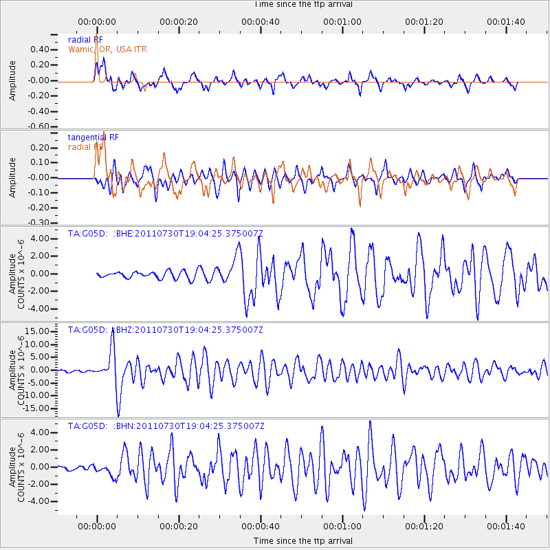
Earthquake location: Near East Coast Of Honshu, Japan
Earthquake latitude/longitude: 36.9/141.0
Earthquake time(UTC): 2011/07/30 (211) 18:53:49 GMT
Earthquake Depth: 30 km
Earthquake Magnitude: 6.4 MB, 6.0 MS, 6.5 MW, 6.4 MW
Earthquake Catalog/Contributor: WHDF/NEIC
Network: TA USArray Transportable Network (new EarthScope stations)
Station: G05D Wamic, OR, USA
Lat/Lon: 45.24 N/121.32 W
Elevation: 592 m
Distance: 69.7 deg
Az: 48.296 deg
Baz: 302.151 deg
Ray Param: 0.055450268
Estimated Moho Depth: 14.0 km
Estimated Crust Vp/Vs: 1.61
Assumed Crust Vp: 6.597 km/s
Estimated Crust Vs: 4.111 km/s
Estimated Crust Poisson's Ratio: 0.18
Radial Match: 85.313774 %
Radial Bump: 400
Transverse Match: 74.738464 %
Transverse Bump: 400
SOD ConfigId: 408116
Insert Time: 2012-01-01 01:11:27.168 +0000
GWidth: 2.5
Max Bumps: 400
Tol: 0.001

Signal To Noise

ChannelStoNSTALTA
TA:G05D: :BHZ:20110730T19:04:25.375007Z22.9516056.480688E-62.8236317E-7
TA:G05D: :BHN:20110730T19:04:25.375007Z3.01308357.27733E-72.4152433E-7
TA:G05D: :BHE:20110730T19:04:25.375007Z3.94816951.5527128E-63.932741E-7
Arrivals
Ps1.3 SECOND
PpPs5.3 SECOND
PsPs/PpSs6.6 SECOND