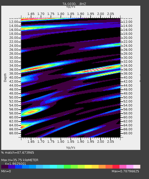
G03D McMinnville, OR, USA - Earthquake Result Viewer
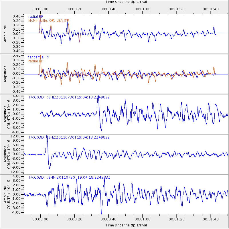
Earthquake location: Near East Coast Of Honshu, Japan
Earthquake latitude/longitude: 36.9/141.0
Earthquake time(UTC): 2011/07/30 (211) 18:53:49 GMT
Earthquake Depth: 30 km
Earthquake Magnitude: 6.4 MB, 6.0 MS, 6.5 MW, 6.4 MW
Earthquake Catalog/Contributor: WHDF/NEIC
Network: TA USArray Transportable Network (new EarthScope stations)
Station: G03D McMinnville, OR, USA
Lat/Lon: 45.21 N/123.26 W
Elevation: 222 m
Distance: 68.5 deg
Az: 49.096 deg
Baz: 301.059 deg
Ray Param: 0.056211445
Estimated Moho Depth: 35.75 km
Estimated Crust Vp/Vs: 1.98
Assumed Crust Vp: 6.566 km/s
Estimated Crust Vs: 3.312 km/s
Estimated Crust Poisson's Ratio: 0.33
Radial Match: 87.673965 %
Radial Bump: 400
Transverse Match: 80.61808 %
Transverse Bump: 400
SOD ConfigId: 408116
Insert Time: 2012-01-01 01:11:43.796 +0000
GWidth: 2.5
Max Bumps: 400
Tol: 0.001

Signal To Noise

ChannelStoNSTALTA
TA:G03D: :BHZ:20110730T19:04:18.224983Z16.6439324.8761594E-62.929692E-7
TA:G03D: :BHN:20110730T19:04:18.224983Z3.5155118.898771E-72.531288E-7
TA:G03D: :BHE:20110730T19:04:18.224983Z5.22709231.5722641E-63.0079133E-7
Arrivals
Ps5.5 SECOND
PpPs16 SECOND
PsPs/PpSs21 SECOND