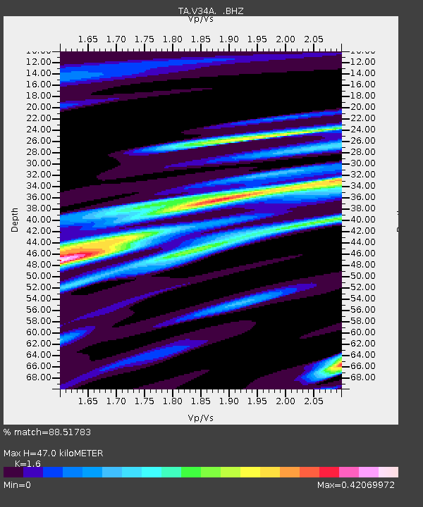
V34A Guthrie, OK, USA - Earthquake Result Viewer
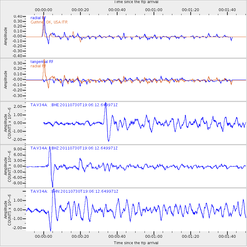
Earthquake location: Near East Coast Of Honshu, Japan
Earthquake latitude/longitude: 36.9/141.0
Earthquake time(UTC): 2011/07/30 (211) 18:53:49 GMT
Earthquake Depth: 30 km
Earthquake Magnitude: 6.4 MB, 6.0 MS, 6.5 MW, 6.4 MW
Earthquake Catalog/Contributor: WHDF/NEIC
Network: TA USArray Transportable Network (new EarthScope stations)
Station: V34A Guthrie, OK, USA
Lat/Lon: 35.83 N/97.52 W
Elevation: 329 m
Distance: 89.5 deg
Az: 43.843 deg
Baz: 316.925 deg
Ray Param: 0.04175747
Estimated Moho Depth: 47.0 km
Estimated Crust Vp/Vs: 1.60
Assumed Crust Vp: 6.426 km/s
Estimated Crust Vs: 4.016 km/s
Estimated Crust Poisson's Ratio: 0.18
Radial Match: 88.51783 %
Radial Bump: 282
Transverse Match: 82.92382 %
Transverse Bump: 400
SOD ConfigId: 408116
Insert Time: 2012-01-01 01:12:43.641 +0000
GWidth: 2.5
Max Bumps: 400
Tol: 0.001

Signal To Noise

ChannelStoNSTALTA
TA:V34A: :BHZ:20110730T19:06:12.649971Z51.916384.8023026E-69.250071E-8
TA:V34A: :BHN:20110730T19:06:12.649971Z4.20055689.285528E-72.210547E-7
TA:V34A: :BHE:20110730T19:06:12.649971Z8.13534459.22465E-71.1338979E-7
Arrivals
Ps4.5 SECOND
PpPs19 SECOND
PsPs/PpSs23 SECOND