N02D Trinity Center, CA, USA - Earthquake Result Viewer
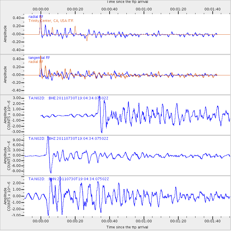
Earthquake location: Near East Coast Of Honshu, Japan
Earthquake latitude/longitude: 36.9/141.0
Earthquake time(UTC): 2011/07/30 (211) 18:53:49 GMT
Earthquake Depth: 30 km
Earthquake Magnitude: 6.4 MB, 6.0 MS, 6.5 MW, 6.4 MW
Earthquake Catalog/Contributor: WHDF/NEIC
Network: TA USArray Transportable Network (new EarthScope stations)
Station: N02D Trinity Center, CA, USA
Lat/Lon: 40.97 N/122.71 W
Elevation: 937 m
Distance: 71.1 deg
Az: 52.698 deg
Baz: 302.684 deg
Ray Param: 0.05450435
Estimated Moho Depth: 24.25 km
Estimated Crust Vp/Vs: 1.76
Assumed Crust Vp: 6.566 km/s
Estimated Crust Vs: 3.731 km/s
Estimated Crust Poisson's Ratio: 0.26
Radial Match: 93.87968 %
Radial Bump: 400
Transverse Match: 89.8068 %
Transverse Bump: 400
SOD ConfigId: 408116
Insert Time: 2012-01-01 01:12:56.713 +0000
GWidth: 2.5
Max Bumps: 400
Tol: 0.001

Signal To Noise

ChannelStoNSTALTA
TA:N02D: :BHZ:20110730T19:04:34.07502Z40.072474.2830447E-61.0688247E-7
TA:N02D: :BHN:20110730T19:04:34.07502Z4.46174051.0564311E-62.3677556E-7
TA:N02D: :BHE:20110730T19:04:34.07502Z8.9383191.2568853E-61.4061763E-7
Arrivals
Ps2.9 SECOND
PpPs9.8 SECOND
PsPs/PpSs13 SECOND