
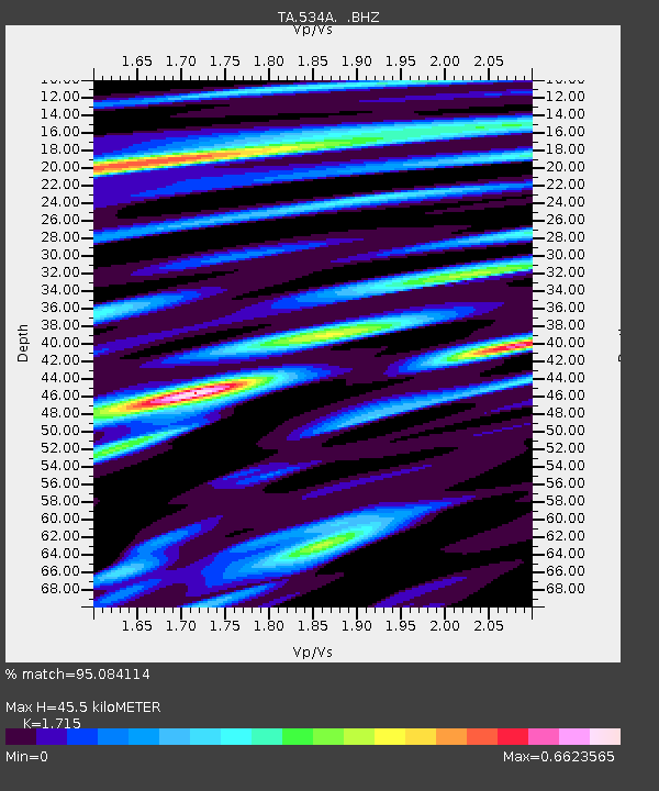
534A Blanco, TX, USA - Earthquake Result Viewer
| ||||||||||||||||||
| ||||||||||||||||||
| ||||||||||||||||||
|
Signal To Noise
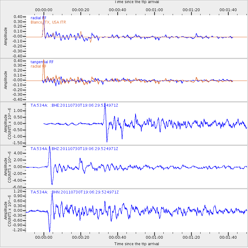
| Channel | StoN | STA | LTA |
| TA:534A: :BHZ:20110730T19:06:29.524971Z | 69.39515 | 2.7327942E-6 | 3.938019E-8 |
| TA:534A: :BHN:20110730T19:06:29.524971Z | 13.032227 | 5.542199E-7 | 4.252688E-8 |
| TA:534A: :BHE:20110730T19:06:29.524971Z | 15.9901285 | 6.6468533E-7 | 4.156848E-8 |
| Arrivals | |
| Ps | 5.1 SECOND |
| PpPs | 19 SECOND |
| PsPs/PpSs | 24 SECOND |

