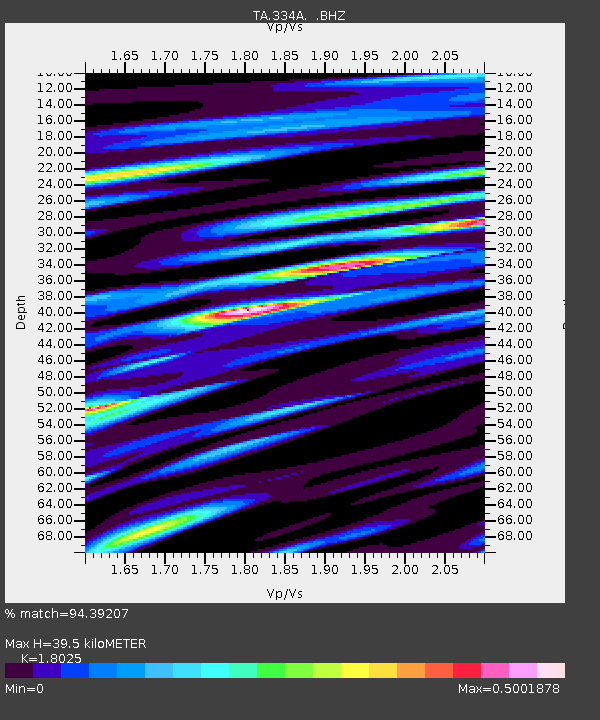
334A Lometa, TX, USA - Earthquake Result Viewer
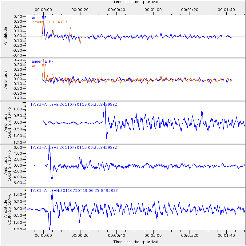
Earthquake location: Near East Coast Of Honshu, Japan
Earthquake latitude/longitude: 36.9/141.0
Earthquake time(UTC): 2011/07/30 (211) 18:53:49 GMT
Earthquake Depth: 30 km
Earthquake Magnitude: 6.4 MB, 6.0 MS, 6.5 MW, 6.4 MW
Earthquake Catalog/Contributor: WHDF/NEIC
Network: TA USArray Transportable Network (new EarthScope stations)
Station: 334A Lometa, TX, USA
Lat/Lon: 31.33 N/98.24 W
Elevation: 389 m
Distance: 92.4 deg
Az: 47.36 deg
Baz: 316.47 deg
Ray Param: 0.04146079
Estimated Moho Depth: 39.5 km
Estimated Crust Vp/Vs: 1.80
Assumed Crust Vp: 6.498 km/s
Estimated Crust Vs: 3.605 km/s
Estimated Crust Poisson's Ratio: 0.28
Radial Match: 94.39207 %
Radial Bump: 400
Transverse Match: 81.70306 %
Transverse Bump: 400
SOD ConfigId: 408116
Insert Time: 2012-01-01 01:14:14.068 +0000
GWidth: 2.5
Max Bumps: 400
Tol: 0.001

Signal To Noise

ChannelStoNSTALTA
TA:334A: :BHZ:20110730T19:06:25.849983Z47.5665362.8144934E-65.916961E-8
TA:334A: :BHN:20110730T19:06:25.849983Z9.8430266.46967E-76.572847E-8
TA:334A: :BHE:20110730T19:06:25.849983Z11.6109696.4688487E-75.571326E-8
Arrivals
Ps5.0 SECOND
PpPs17 SECOND
PsPs/PpSs22 SECOND