CLF Chambon la Foret observatory, France - Earthquake Result Viewer
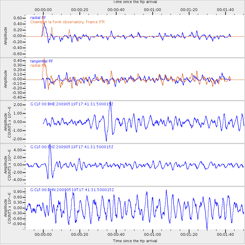
Earthquake location: Western Arabian Peninsula
Earthquake latitude/longitude: 25.3/37.7
Earthquake time(UTC): 2009/05/19 (139) 17:35:00 GMT
Earthquake Depth: 2.0 km
Earthquake Magnitude: 5.7 MB, 5.3 MS, 5.7 MW, 5.7 MW
Earthquake Catalog/Contributor: WHDF/NEIC
Network: G GEOSCOPE
Station: CLF Chambon la Foret observatory, France
Lat/Lon: 48.03 N/2.26 E
Elevation: 145 m
Distance: 35.9 deg
Az: 318.39 deg
Baz: 116.426 deg
Ray Param: 0.0769774
Estimated Moho Depth: 10.25 km
Estimated Crust Vp/Vs: 1.85
Assumed Crust Vp: 6.12 km/s
Estimated Crust Vs: 3.304 km/s
Estimated Crust Poisson's Ratio: 0.29
Radial Match: 82.27531 %
Radial Bump: 398
Transverse Match: 67.39958 %
Transverse Bump: 340
SOD ConfigId: 2760
Insert Time: 2010-02-26 21:53:16.121 +0000
GWidth: 2.5
Max Bumps: 400
Tol: 0.001

Signal To Noise

ChannelStoNSTALTA
G:CLF:00:BHZ:20090519T17:41:31.500015Z8.1432862.4130723E-62.9632662E-7
G:CLF:00:BHN:20090519T17:41:31.500015Z1.40261973.795298E-72.705864E-7
G:CLF:00:BHE:20090519T17:41:31.500015Z3.75800568.312233E-72.2118735E-7
Arrivals
Ps1.5 SECOND
PpPs4.5 SECOND
PsPs/PpSs6.0 SECOND