
W36A Wetumka, OK, USA - Earthquake Result Viewer
| ||||||||||||||||||
| ||||||||||||||||||
| ||||||||||||||||||
|
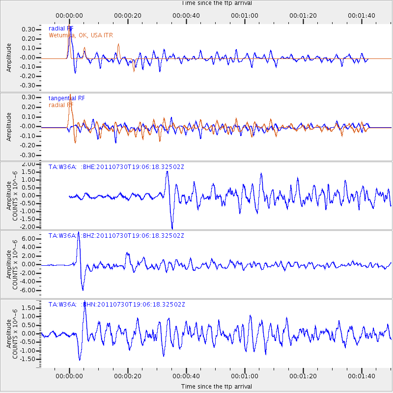
Signal To Noise
| Channel | StoN | STA | LTA |
| TA:W36A: :BHZ:20110730T19:06:18.32502Z | 41.56449 | 3.329841E-6 | 8.011264E-8 |
| TA:W36A: :BHN:20110730T19:06:18.32502Z | 5.819012 | 6.058376E-7 | 1.0411348E-7 |
| TA:W36A: :BHE:20110730T19:06:18.32502Z | 6.985946 | 6.938992E-7 | 9.932788E-8 |
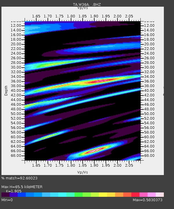
| Arrivals | |
| Ps | 9.4 SECOND |
| PpPs | 29 SECOND |
| PsPs/PpSs | 38 SECOND |

