You are here: Home > Network List > TA - USArray Transportable Network (new EarthScope stations) Stations List
> Station Z38A Mt. Pleasant, TX, USA > Earthquake Result Viewer
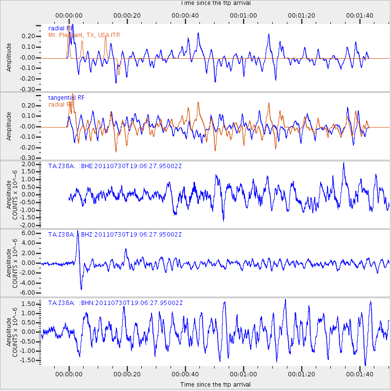
Z38A Mt. Pleasant, TX, USA - Earthquake Result Viewer
*The percent match for this event was below the threshold and hence no stack was calculated.
| Earthquake location: |
Near East Coast Of Honshu, Japan |
| Earthquake latitude/longitude: |
36.9/141.0 |
| Earthquake time(UTC): |
2011/07/30 (211) 18:53:49 GMT |
| Earthquake Depth: |
30 km |
| Earthquake Magnitude: |
6.4 MB, 6.0 MS, 6.5 MW, 6.4 MW |
| Earthquake Catalog/Contributor: |
WHDF/NEIC |
|
| Network: |
TA USArray Transportable Network (new EarthScope stations) |
| Station: |
Z38A Mt. Pleasant, TX, USA |
| Lat/Lon: |
33.25 N/94.99 W |
| Elevation: |
116 m |
|
| Distance: |
92.8 deg |
| Az: |
44.035 deg |
| Baz: |
318.351 deg |
| Ray Param: |
$rayparam |
*The percent match for this event was below the threshold and hence was not used in the summary stack. |
|
| Radial Match: |
80.39045 % |
| Radial Bump: |
400 |
| Transverse Match: |
70.38604 % |
| Transverse Bump: |
400 |
| SOD ConfigId: |
408116 |
| Insert Time: |
2012-01-01 01:19:02.104 +0000 |
| GWidth: |
2.5 |
| Max Bumps: |
400 |
| Tol: |
0.001 |
|
Signal To Noise
| Channel | StoN | STA | LTA |
| TA:Z38A: :BHZ:20110730T19:06:27.95002Z | 22.415283 | 2.6808218E-6 | 1.1959796E-7 |
| TA:Z38A: :BHN:20110730T19:06:27.95002Z | 1.9500104 | 5.0397114E-7 | 2.5844537E-7 |
| TA:Z38A: :BHE:20110730T19:06:27.95002Z | 1.4453812 | 3.7220977E-7 | 2.575167E-7 |
| Arrivals |
| Ps | |
| PpPs | |
| PsPs/PpSs | |


