You are here: Home > Network List > TA - USArray Transportable Network (new EarthScope stations) Stations List
> Station Y36A Durant, OK, USA > Earthquake Result Viewer
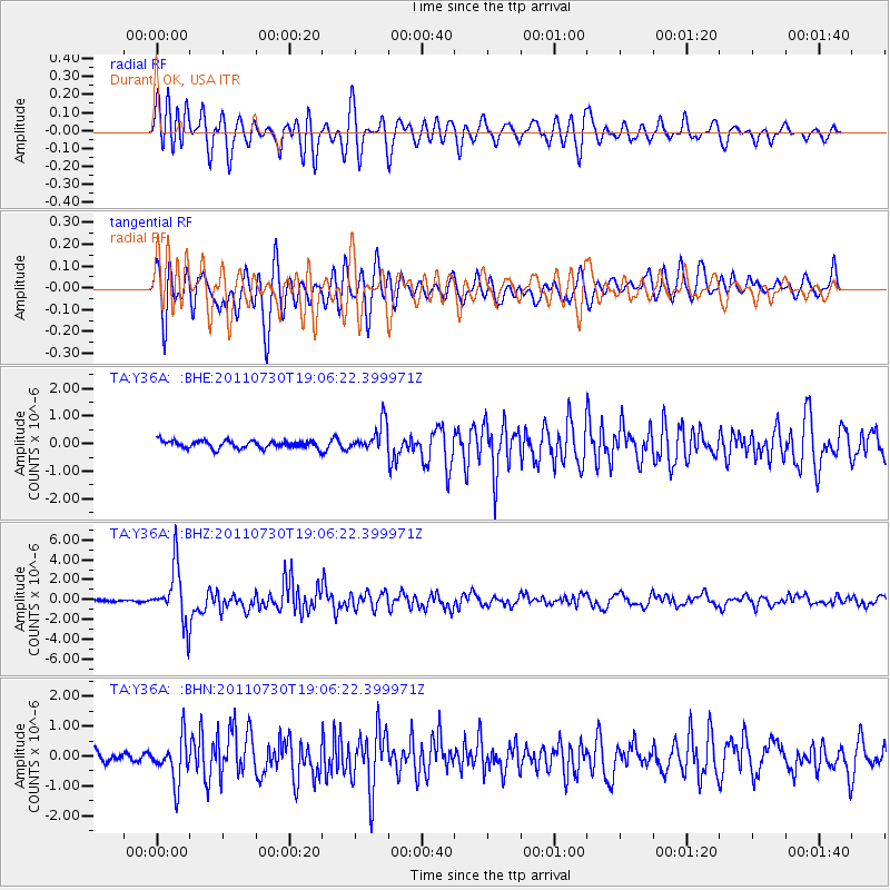
Y36A Durant, OK, USA - Earthquake Result Viewer
*The percent match for this event was below the threshold and hence no stack was calculated.
| Earthquake location: |
Near East Coast Of Honshu, Japan |
| Earthquake latitude/longitude: |
36.9/141.0 |
| Earthquake time(UTC): |
2011/07/30 (211) 18:53:49 GMT |
| Earthquake Depth: |
30 km |
| Earthquake Magnitude: |
6.4 MB, 6.0 MS, 6.5 MW, 6.4 MW |
| Earthquake Catalog/Contributor: |
WHDF/NEIC |
|
| Network: |
TA USArray Transportable Network (new EarthScope stations) |
| Station: |
Y36A Durant, OK, USA |
| Lat/Lon: |
33.90 N/96.28 W |
| Elevation: |
186 m |
|
| Distance: |
91.6 deg |
| Az: |
44.408 deg |
| Baz: |
317.621 deg |
| Ray Param: |
$rayparam |
*The percent match for this event was below the threshold and hence was not used in the summary stack. |
|
| Radial Match: |
82.54638 % |
| Radial Bump: |
400 |
| Transverse Match: |
85.2038 % |
| Transverse Bump: |
400 |
| SOD ConfigId: |
408116 |
| Insert Time: |
2012-01-01 01:19:23.597 +0000 |
| GWidth: |
2.5 |
| Max Bumps: |
400 |
| Tol: |
0.001 |
|
Signal To Noise
| Channel | StoN | STA | LTA |
| TA:Y36A: :BHZ:20110730T19:06:22.399971Z | 19.578817 | 2.783257E-6 | 1.4215655E-7 |
| TA:Y36A: :BHN:20110730T19:06:22.399971Z | 3.8037987 | 7.267404E-7 | 1.9105649E-7 |
| TA:Y36A: :BHE:20110730T19:06:22.399971Z | 3.8815703 | 5.2016526E-7 | 1.3400897E-7 |
| Arrivals |
| Ps | |
| PpPs | |
| PsPs/PpSs | |


