N34A Lincoln, NE, USA - Earthquake Result Viewer
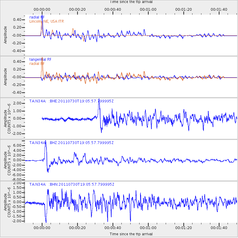
Earthquake location: Near East Coast Of Honshu, Japan
Earthquake latitude/longitude: 36.9/141.0
Earthquake time(UTC): 2011/07/30 (211) 18:53:49 GMT
Earthquake Depth: 30 km
Earthquake Magnitude: 6.4 MB, 6.0 MS, 6.5 MW, 6.4 MW
Earthquake Catalog/Contributor: WHDF/NEIC
Network: TA USArray Transportable Network (new EarthScope stations)
Station: N34A Lincoln, NE, USA
Lat/Lon: 40.84 N/96.50 W
Elevation: 401 m
Distance: 86.4 deg
Az: 39.858 deg
Baz: 317.411 deg
Ray Param: 0.044045474
Estimated Moho Depth: 42.5 km
Estimated Crust Vp/Vs: 1.91
Assumed Crust Vp: 6.498 km/s
Estimated Crust Vs: 3.406 km/s
Estimated Crust Poisson's Ratio: 0.31
Radial Match: 93.67228 %
Radial Bump: 400
Transverse Match: 86.625275 %
Transverse Bump: 400
SOD ConfigId: 408116
Insert Time: 2012-01-01 01:20:06.094 +0000
GWidth: 2.5
Max Bumps: 400
Tol: 0.001

Signal To Noise

ChannelStoNSTALTA
TA:N34A: :BHZ:20110730T19:05:57.799995Z42.4046673.4398345E-68.1119246E-8
TA:N34A: :BHN:20110730T19:05:57.799995Z9.7817128.4741464E-78.6632554E-8
TA:N34A: :BHE:20110730T19:05:57.799995Z11.3081311.0778982E-69.532064E-8
Arrivals
Ps6.1 SECOND
PpPs19 SECOND
PsPs/PpSs25 SECOND