V37A Hulbert, OK, USA - Earthquake Result Viewer
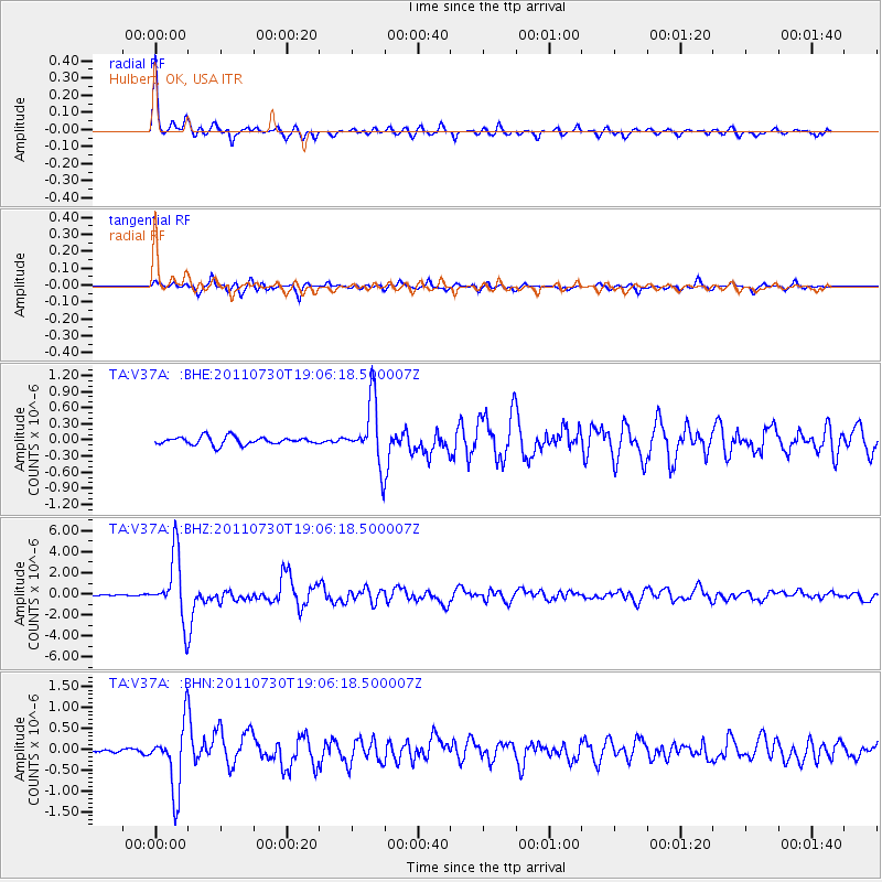
Earthquake location: Near East Coast Of Honshu, Japan
Earthquake latitude/longitude: 36.9/141.0
Earthquake time(UTC): 2011/07/30 (211) 18:53:49 GMT
Earthquake Depth: 30 km
Earthquake Magnitude: 6.4 MB, 6.0 MS, 6.5 MW, 6.4 MW
Earthquake Catalog/Contributor: WHDF/NEIC
Network: TA USArray Transportable Network (new EarthScope stations)
Station: V37A Hulbert, OK, USA
Lat/Lon: 35.88 N/95.14 W
Elevation: 219 m
Distance: 90.8 deg
Az: 42.384 deg
Baz: 318.315 deg
Ray Param: 0.04164538
Estimated Moho Depth: 21.25 km
Estimated Crust Vp/Vs: 1.82
Assumed Crust Vp: 6.498 km/s
Estimated Crust Vs: 3.565 km/s
Estimated Crust Poisson's Ratio: 0.28
Radial Match: 96.647575 %
Radial Bump: 319
Transverse Match: 87.67154 %
Transverse Bump: 400
SOD ConfigId: 408116
Insert Time: 2012-01-01 01:22:02.743 +0000
GWidth: 2.5
Max Bumps: 400
Tol: 0.001

Signal To Noise

ChannelStoNSTALTA
TA:V37A: :BHZ:20110730T19:06:18.500007Z55.6794433.0256526E-65.4340568E-8
TA:V37A: :BHN:20110730T19:06:18.500007Z20.509647.80886E-73.80741E-8
TA:V37A: :BHE:20110730T19:06:18.500007Z8.0115115.865778E-77.3216874E-8
Arrivals
Ps2.7 SECOND
PpPs9.0 SECOND
PsPs/PpSs12 SECOND