U36A Oologah, OK, USA - Earthquake Result Viewer
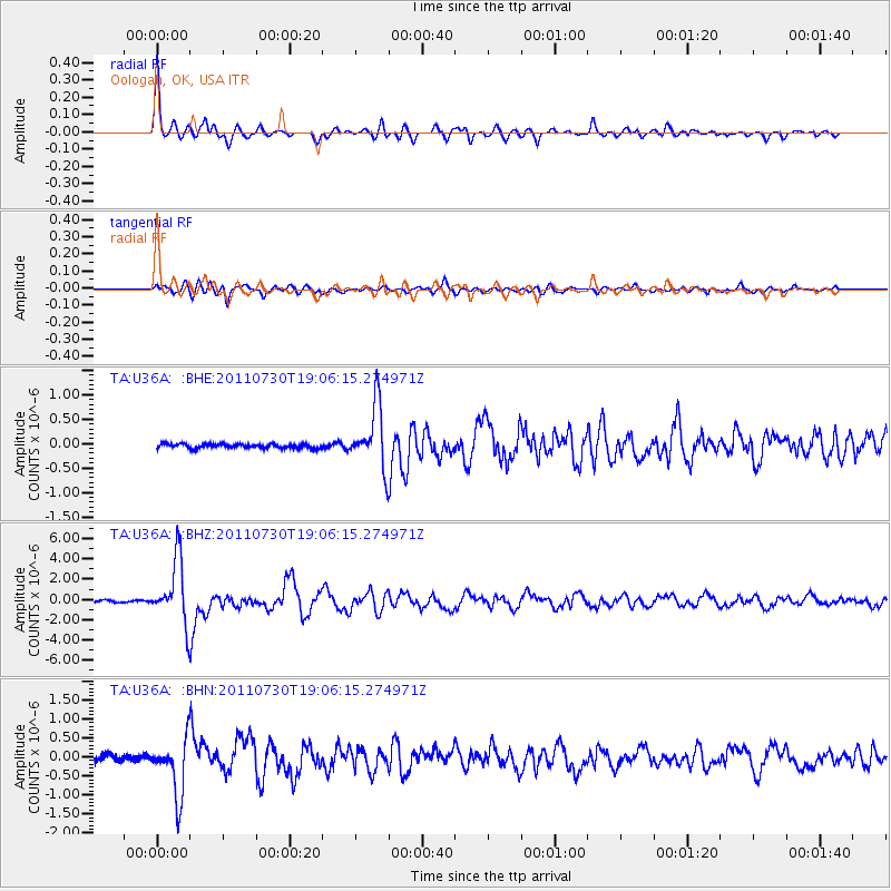
Earthquake location: Near East Coast Of Honshu, Japan
Earthquake latitude/longitude: 36.9/141.0
Earthquake time(UTC): 2011/07/30 (211) 18:53:49 GMT
Earthquake Depth: 30 km
Earthquake Magnitude: 6.4 MB, 6.0 MS, 6.5 MW, 6.4 MW
Earthquake Catalog/Contributor: WHDF/NEIC
Network: TA USArray Transportable Network (new EarthScope stations)
Station: U36A Oologah, OK, USA
Lat/Lon: 36.39 N/95.73 W
Elevation: 187 m
Distance: 90.1 deg
Az: 42.401 deg
Baz: 317.967 deg
Ray Param: 0.041695185
Estimated Moho Depth: 20.25 km
Estimated Crust Vp/Vs: 1.80
Assumed Crust Vp: 6.53 km/s
Estimated Crust Vs: 3.633 km/s
Estimated Crust Poisson's Ratio: 0.28
Radial Match: 94.682945 %
Radial Bump: 348
Transverse Match: 85.474014 %
Transverse Bump: 400
SOD ConfigId: 408116
Insert Time: 2012-01-01 01:22:45.844 +0000
GWidth: 2.5
Max Bumps: 400
Tol: 0.001

Signal To Noise

ChannelStoNSTALTA
TA:U36A: :BHZ:20110730T19:06:15.274971Z36.372623.097558E-68.516181E-8
TA:U36A: :BHN:20110730T19:06:15.274971Z9.9887357.5047063E-77.51317E-8
TA:U36A: :BHE:20110730T19:06:15.274971Z14.6711016.337901E-74.31999E-8
Arrivals
Ps2.5 SECOND
PpPs8.5 SECOND
PsPs/PpSs11 SECOND