K34A Le Mars, IA, USA - Earthquake Result Viewer
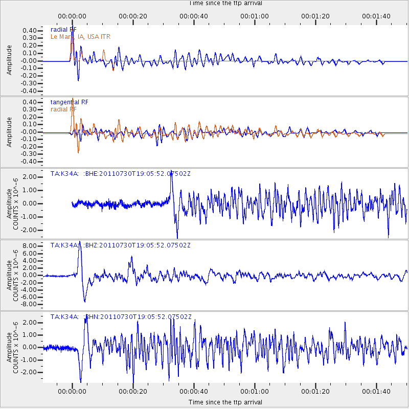
Earthquake location: Near East Coast Of Honshu, Japan
Earthquake latitude/longitude: 36.9/141.0
Earthquake time(UTC): 2011/07/30 (211) 18:53:49 GMT
Earthquake Depth: 30 km
Earthquake Magnitude: 6.4 MB, 6.0 MS, 6.5 MW, 6.4 MW
Earthquake Catalog/Contributor: WHDF/NEIC
Network: TA USArray Transportable Network (new EarthScope stations)
Station: K34A Le Mars, IA, USA
Lat/Lon: 42.69 N/96.10 W
Elevation: 436 m
Distance: 85.2 deg
Az: 38.383 deg
Baz: 317.572 deg
Ray Param: 0.04486983
Estimated Moho Depth: 20.0 km
Estimated Crust Vp/Vs: 1.97
Assumed Crust Vp: 6.498 km/s
Estimated Crust Vs: 3.294 km/s
Estimated Crust Poisson's Ratio: 0.33
Radial Match: 88.42086 %
Radial Bump: 400
Transverse Match: 75.592705 %
Transverse Bump: 400
SOD ConfigId: 408116
Insert Time: 2012-01-01 01:23:27.483 +0000
GWidth: 2.5
Max Bumps: 400
Tol: 0.001

Signal To Noise

ChannelStoNSTALTA
TA:K34A: :BHZ:20110730T19:05:52.07502Z42.39944.452E-61.050015E-7
TA:K34A: :BHN:20110730T19:05:52.07502Z9.0090871.2838177E-61.4250254E-7
TA:K34A: :BHE:20110730T19:05:52.07502Z7.3387711.1088406E-61.510935E-7
Arrivals
Ps3.1 SECOND
PpPs8.9 SECOND
PsPs/PpSs12 SECOND