
K35A Storm Lake, IA, USA - Earthquake Result Viewer
| ||||||||||||||||||
| ||||||||||||||||||
| ||||||||||||||||||
|
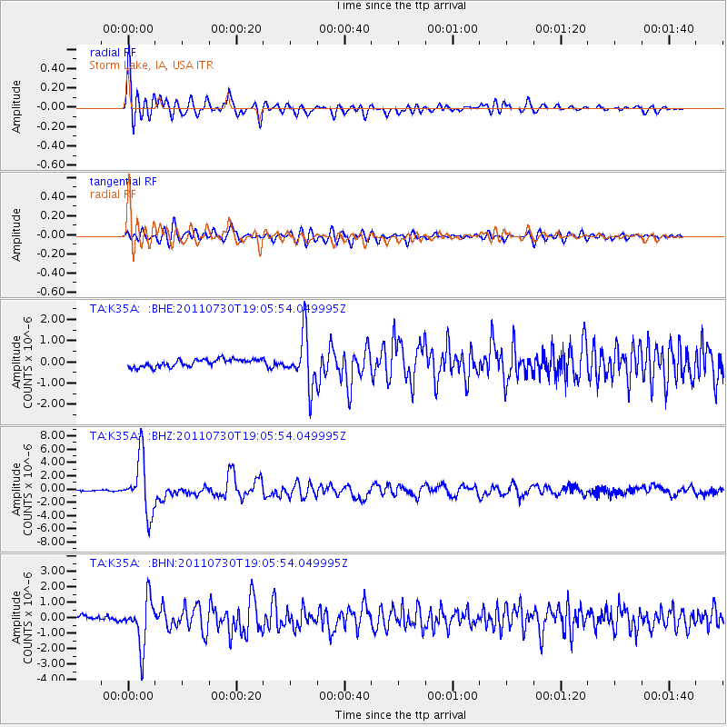
Signal To Noise
| Channel | StoN | STA | LTA |
| TA:K35A: :BHZ:20110730T19:05:54.049995Z | 59.58869 | 4.228931E-6 | 7.096869E-8 |
| TA:K35A: :BHN:20110730T19:05:54.049995Z | 10.945653 | 1.5297973E-6 | 1.3976299E-7 |
| TA:K35A: :BHE:20110730T19:05:54.049995Z | 6.89315 | 1.2196298E-6 | 1.769336E-7 |
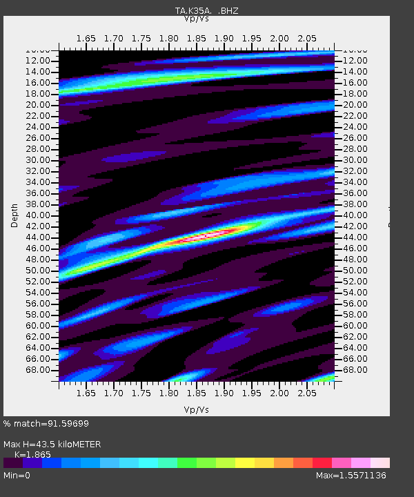
| Arrivals | |
| Ps | 5.9 SECOND |
| PpPs | 19 SECOND |
| PsPs/PpSs | 25 SECOND |

