H04D Lebanon, OR, USA - Earthquake Result Viewer
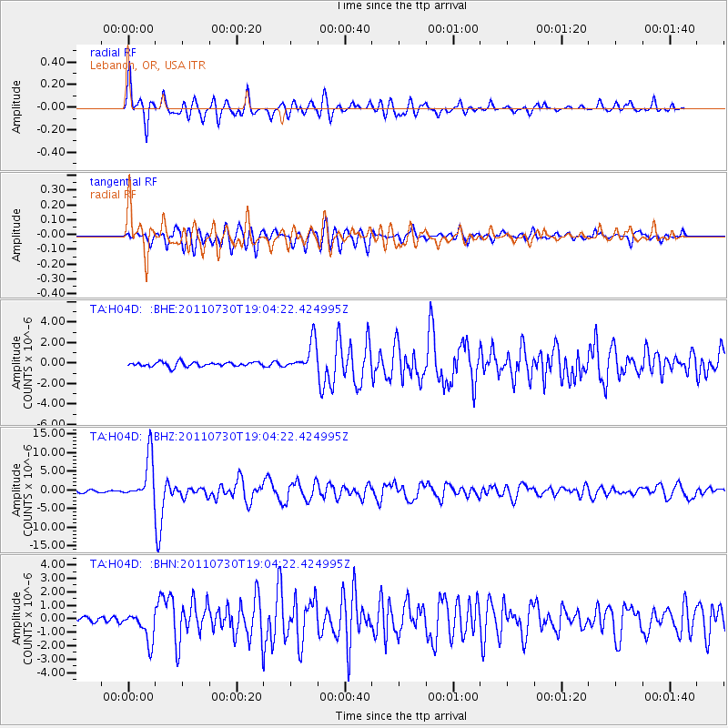
Earthquake location: Near East Coast Of Honshu, Japan
Earthquake latitude/longitude: 36.9/141.0
Earthquake time(UTC): 2011/07/30 (211) 18:53:49 GMT
Earthquake Depth: 30 km
Earthquake Magnitude: 6.4 MB, 6.0 MS, 6.5 MW, 6.4 MW
Earthquake Catalog/Contributor: WHDF/NEIC
Network: TA USArray Transportable Network (new EarthScope stations)
Station: H04D Lebanon, OR, USA
Lat/Lon: 44.52 N/122.74 W
Elevation: 284 m
Distance: 69.2 deg
Az: 49.518 deg
Baz: 301.581 deg
Ray Param: 0.05576813
Estimated Moho Depth: 27.25 km
Estimated Crust Vp/Vs: 2.05
Assumed Crust Vp: 6.566 km/s
Estimated Crust Vs: 3.207 km/s
Estimated Crust Poisson's Ratio: 0.34
Radial Match: 88.55137 %
Radial Bump: 400
Transverse Match: 76.068535 %
Transverse Bump: 400
SOD ConfigId: 408116
Insert Time: 2012-01-01 01:25:03.897 +0000
GWidth: 2.5
Max Bumps: 400
Tol: 0.001

Signal To Noise

ChannelStoNSTALTA
TA:H04D: :BHZ:20110730T19:04:22.424995Z24.5138535.9620306E-62.4321068E-7
TA:H04D: :BHN:20110730T19:04:22.424995Z4.20161631.1177499E-62.6602854E-7
TA:H04D: :BHE:20110730T19:04:22.424995Z6.837561.4589546E-62.1337357E-7
Arrivals
Ps4.5 SECOND
PpPs12 SECOND
PsPs/PpSs17 SECOND