K31A O'Neill, NE, USA - Earthquake Result Viewer
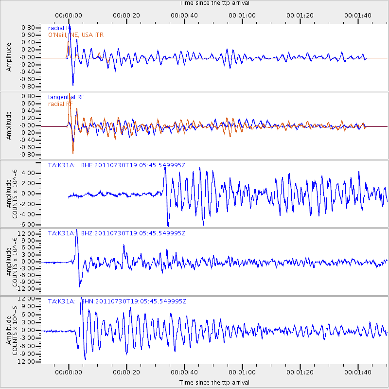
Earthquake location: Near East Coast Of Honshu, Japan
Earthquake latitude/longitude: 36.9/141.0
Earthquake time(UTC): 2011/07/30 (211) 18:53:49 GMT
Earthquake Depth: 30 km
Earthquake Magnitude: 6.4 MB, 6.0 MS, 6.5 MW, 6.4 MW
Earthquake Catalog/Contributor: WHDF/NEIC
Network: TA USArray Transportable Network (new EarthScope stations)
Station: K31A O'Neill, NE, USA
Lat/Lon: 42.62 N/98.75 W
Elevation: 580 m
Distance: 83.9 deg
Az: 39.861 deg
Baz: 315.916 deg
Ray Param: 0.045791738
Estimated Moho Depth: 17.0 km
Estimated Crust Vp/Vs: 2.07
Assumed Crust Vp: 6.53 km/s
Estimated Crust Vs: 3.162 km/s
Estimated Crust Poisson's Ratio: 0.35
Radial Match: 97.29721 %
Radial Bump: 356
Transverse Match: 95.63413 %
Transverse Bump: 400
SOD ConfigId: 408116
Insert Time: 2012-01-01 01:25:53.773 +0000
GWidth: 2.5
Max Bumps: 400
Tol: 0.001

Signal To Noise

ChannelStoNSTALTA
TA:K31A: :BHZ:20110730T19:05:45.549995Z62.881056.051553E-69.6238104E-8
TA:K31A: :BHN:20110730T19:05:45.549995Z16.2535114.9005725E-63.0150852E-7
TA:K31A: :BHE:20110730T19:05:45.549995Z11.436192.6761788E-62.3400966E-7
Arrivals
Ps2.8 SECOND
PpPs7.8 SECOND
PsPs/PpSs11 SECOND