H31A Wolsey, SD, USA - Earthquake Result Viewer
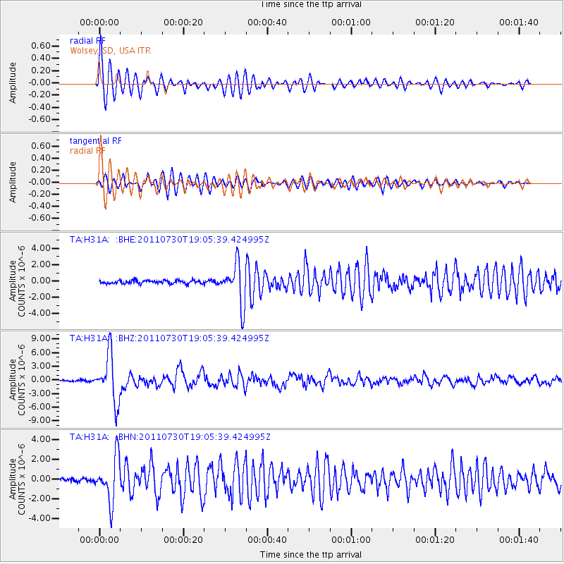
Earthquake location: Near East Coast Of Honshu, Japan
Earthquake latitude/longitude: 36.9/141.0
Earthquake time(UTC): 2011/07/30 (211) 18:53:49 GMT
Earthquake Depth: 30 km
Earthquake Magnitude: 6.4 MB, 6.0 MS, 6.5 MW, 6.4 MW
Earthquake Catalog/Contributor: WHDF/NEIC
Network: TA USArray Transportable Network (new EarthScope stations)
Station: H31A Wolsey, SD, USA
Lat/Lon: 44.48 N/98.48 W
Elevation: 415 m
Distance: 82.7 deg
Az: 38.416 deg
Baz: 315.939 deg
Ray Param: 0.04663423
Estimated Moho Depth: 28.25 km
Estimated Crust Vp/Vs: 1.60
Assumed Crust Vp: 6.53 km/s
Estimated Crust Vs: 4.082 km/s
Estimated Crust Poisson's Ratio: 0.18
Radial Match: 95.49705 %
Radial Bump: 400
Transverse Match: 87.445045 %
Transverse Bump: 400
SOD ConfigId: 408116
Insert Time: 2012-01-01 01:26:06.463 +0000
GWidth: 2.5
Max Bumps: 400
Tol: 0.001

Signal To Noise

ChannelStoNSTALTA
TA:H31A: :BHZ:20110730T19:05:39.424995Z48.527525.4184334E-61.11656924E-7
TA:H31A: :BHN:20110730T19:05:39.424995Z17.4460772.3355772E-61.3387405E-7
TA:H31A: :BHE:20110730T19:05:39.424995Z13.4273932.5826812E-61.923442E-7
Arrivals
Ps2.7 SECOND
PpPs11 SECOND
PsPs/PpSs14 SECOND