E04D Cinebar, WA, USA - Earthquake Result Viewer
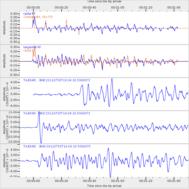
Earthquake location: Near East Coast Of Honshu, Japan
Earthquake latitude/longitude: 36.9/141.0
Earthquake time(UTC): 2011/07/30 (211) 18:53:49 GMT
Earthquake Depth: 30 km
Earthquake Magnitude: 6.4 MB, 6.0 MS, 6.5 MW, 6.4 MW
Earthquake Catalog/Contributor: WHDF/NEIC
Network: TA USArray Transportable Network (new EarthScope stations)
Station: E04D Cinebar, WA, USA
Lat/Lon: 46.56 N/122.57 W
Elevation: 204 m
Distance: 68.2 deg
Az: 47.586 deg
Baz: 301.001 deg
Ray Param: 0.05639214
Estimated Moho Depth: 53.25 km
Estimated Crust Vp/Vs: 2.04
Assumed Crust Vp: 6.566 km/s
Estimated Crust Vs: 3.219 km/s
Estimated Crust Poisson's Ratio: 0.34
Radial Match: 84.273026 %
Radial Bump: 400
Transverse Match: 79.284355 %
Transverse Bump: 400
SOD ConfigId: 408116
Insert Time: 2012-01-01 01:26:44.116 +0000
GWidth: 2.5
Max Bumps: 400
Tol: 0.001

Signal To Noise

ChannelStoNSTALTA
TA:E04D: :BHZ:20110730T19:04:16.500007Z45.8298656.014872E-61.312435E-7
TA:E04D: :BHN:20110730T19:04:16.500007Z5.4354478.9955216E-71.6549735E-7
TA:E04D: :BHE:20110730T19:04:16.500007Z9.200531.3419868E-61.4585973E-7
Arrivals
Ps8.7 SECOND
PpPs24 SECOND
PsPs/PpSs33 SECOND