D36A Goodland, MN, USA - Earthquake Result Viewer
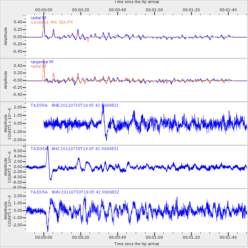
Earthquake location: Near East Coast Of Honshu, Japan
Earthquake latitude/longitude: 36.9/141.0
Earthquake time(UTC): 2011/07/30 (211) 18:53:49 GMT
Earthquake Depth: 30 km
Earthquake Magnitude: 6.4 MB, 6.0 MS, 6.5 MW, 6.4 MW
Earthquake Catalog/Contributor: WHDF/NEIC
Network: TA USArray Transportable Network (new EarthScope stations)
Station: D36A Goodland, MN, USA
Lat/Lon: 47.18 N/93.16 W
Elevation: 434 m
Distance: 83.3 deg
Az: 33.822 deg
Baz: 319.18 deg
Ray Param: 0.046272695
Estimated Moho Depth: 45.75 km
Estimated Crust Vp/Vs: 1.75
Assumed Crust Vp: 6.571 km/s
Estimated Crust Vs: 3.749 km/s
Estimated Crust Poisson's Ratio: 0.26
Radial Match: 94.07046 %
Radial Bump: 281
Transverse Match: 84.84037 %
Transverse Bump: 400
SOD ConfigId: 408116
Insert Time: 2012-01-01 01:27:07.797 +0000
GWidth: 2.5
Max Bumps: 400
Tol: 0.001

Signal To Noise

ChannelStoNSTALTA
TA:D36A: :BHZ:20110730T19:05:42.099983Z13.0020173.601425E-62.7698974E-7
TA:D36A: :BHN:20110730T19:05:42.099983Z4.05441431.1734984E-62.8943722E-7
TA:D36A: :BHE:20110730T19:05:42.099983Z3.53714351.073952E-63.0362128E-7
Arrivals
Ps5.4 SECOND
PpPs19 SECOND
PsPs/PpSs24 SECOND