
C06D Leavenworth, WQ, USA - Earthquake Result Viewer
| ||||||||||||||||||
| ||||||||||||||||||
| ||||||||||||||||||
|

Signal To Noise
| Channel | StoN | STA | LTA |
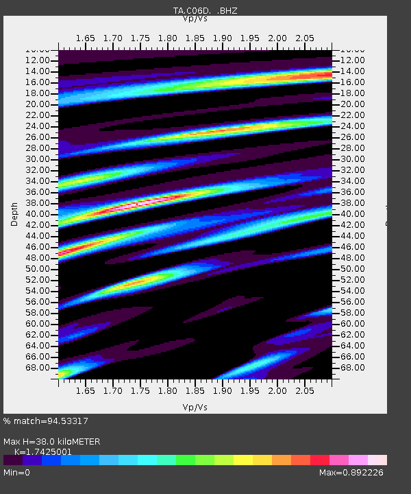
| TA:C06D: :BHZ:20110730T19:04:18.149971Z | 32.84515 | 4.7330745E-6 | 1.441027E-7 |
| TA:C06D: :BHN:20110730T19:04:18.149971Z | 3.8170586 | 1.0149596E-6 | 2.6590095E-7 |
| TA:C06D: :BHE:20110730T19:04:18.149971Z | 5.2508025 | 1.5862E-6 | 3.0208716E-7 |
| Arrivals | |
| Ps | 4.5 SECOND |
| PpPs | 15 SECOND |
| PsPs/PpSs | 20 SECOND |

