F31A Hecla, SD, USA - Earthquake Result Viewer
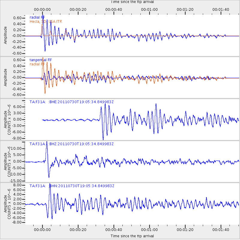
Earthquake location: Near East Coast Of Honshu, Japan
Earthquake latitude/longitude: 36.9/141.0
Earthquake time(UTC): 2011/07/30 (211) 18:53:49 GMT
Earthquake Depth: 30 km
Earthquake Magnitude: 6.4 MB, 6.0 MS, 6.5 MW, 6.4 MW
Earthquake Catalog/Contributor: WHDF/NEIC
Network: TA USArray Transportable Network (new EarthScope stations)
Station: F31A Hecla, SD, USA
Lat/Lon: 45.86 N/98.25 W
Elevation: 412 m
Distance: 81.9 deg
Az: 37.332 deg
Baz: 315.953 deg
Ray Param: 0.047246825
Estimated Moho Depth: 29.25 km
Estimated Crust Vp/Vs: 2.05
Assumed Crust Vp: 6.53 km/s
Estimated Crust Vs: 3.182 km/s
Estimated Crust Poisson's Ratio: 0.34
Radial Match: 96.14096 %
Radial Bump: 311
Transverse Match: 93.07518 %
Transverse Bump: 371
SOD ConfigId: 408116
Insert Time: 2012-01-01 01:27:33.594 +0000
GWidth: 2.5
Max Bumps: 400
Tol: 0.001

Signal To Noise

ChannelStoNSTALTA
TA:F31A: :BHZ:20110730T19:05:34.849983Z77.1962366.6640982E-68.632672E-8
TA:F31A: :BHN:20110730T19:05:34.849983Z16.12353.4528998E-62.1415323E-7
TA:F31A: :BHE:20110730T19:05:34.849983Z15.4422063.5695466E-62.3115521E-7
Arrivals
Ps4.8 SECOND
PpPs13 SECOND
PsPs/PpSs18 SECOND