You are here: Home > Network List > TA - USArray Transportable Network (new EarthScope stations) Stations List
> Station I48A Sherman Twp, MI, USA > Earthquake Result Viewer
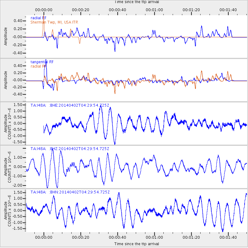
I48A Sherman Twp, MI, USA - Earthquake Result Viewer
*The percent match for this event was below the threshold and hence no stack was calculated.
| Earthquake location: |
Near Coast Of Northern Chile |
| Earthquake latitude/longitude: |
-19.9/-71.0 |
| Earthquake time(UTC): |
2014/04/02 (092) 04:19:48 GMT |
| Earthquake Depth: |
16 km |
| Earthquake Magnitude: |
5.1 mb |
| Earthquake Catalog/Contributor: |
ISC/ISC |
|
| Network: |
TA USArray Transportable Network (new EarthScope stations) |
| Station: |
I48A Sherman Twp, MI, USA |
| Lat/Lon: |
44.19 N/83.70 W |
| Elevation: |
192 m |
|
| Distance: |
64.8 deg |
| Az: |
349.918 deg |
| Baz: |
166.759 deg |
| Ray Param: |
$rayparam |
*The percent match for this event was below the threshold and hence was not used in the summary stack. |
|
| Radial Match: |
67.50997 % |
| Radial Bump: |
400 |
| Transverse Match: |
78.327934 % |
| Transverse Bump: |
400 |
| SOD ConfigId: |
3390531 |
| Insert Time: |
2019-04-11 01:05:17.532 +0000 |
| GWidth: |
2.5 |
| Max Bumps: |
400 |
| Tol: |
0.001 |
|
Signal To Noise
| Channel | StoN | STA | LTA |
| TA:I48A: :BHZ:20140402T04:29:54.725Z | 3.7979548 | 1.3690096E-6 | 3.604597E-7 |
| TA:I48A: :BHN:20140402T04:29:54.725Z | 1.0825697 | 4.081581E-7 | 3.7702705E-7 |
| TA:I48A: :BHE:20140402T04:29:54.725Z | 2.7592793 | 9.272958E-7 | 3.360645E-7 |
| Arrivals |
| Ps | |
| PpPs | |
| PsPs/PpSs | |


