Y40A Okolona, AR, USA - Earthquake Result Viewer
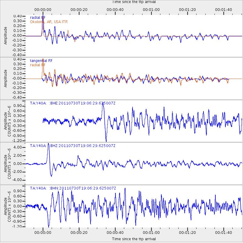
Earthquake location: Near East Coast Of Honshu, Japan
Earthquake latitude/longitude: 36.9/141.0
Earthquake time(UTC): 2011/07/30 (211) 18:53:49 GMT
Earthquake Depth: 30 km
Earthquake Magnitude: 6.4 MB, 6.0 MS, 6.5 MW, 6.4 MW
Earthquake Catalog/Contributor: WHDF/NEIC
Network: TA USArray Transportable Network (new EarthScope stations)
Station: Y40A Okolona, AR, USA
Lat/Lon: 34.01 N/93.28 W
Elevation: 117 m
Distance: 93.2 deg
Az: 42.461 deg
Baz: 319.373 deg
Ray Param: 0.041299626
Estimated Moho Depth: 11.25 km
Estimated Crust Vp/Vs: 1.64
Assumed Crust Vp: 6.498 km/s
Estimated Crust Vs: 3.956 km/s
Estimated Crust Poisson's Ratio: 0.21
Radial Match: 86.61189 %
Radial Bump: 400
Transverse Match: 83.77925 %
Transverse Bump: 400
SOD ConfigId: 408116
Insert Time: 2012-01-01 01:33:14.606 +0000
GWidth: 2.5
Max Bumps: 400
Tol: 0.001

Signal To Noise

ChannelStoNSTALTA
TA:Y40A: :BHZ:20110730T19:06:29.625007Z22.716532.1506528E-69.467347E-8
TA:Y40A: :BHN:20110730T19:06:29.625007Z6.2170264.950972E-77.963569E-8
TA:Y40A: :BHE:20110730T19:06:29.625007Z4.22362575.0470476E-71.1949561E-7
Arrivals
Ps1.1 SECOND
PpPs4.5 SECOND
PsPs/PpSs5.6 SECOND