
W39A Magazine, AR, USA - Earthquake Result Viewer
| ||||||||||||||||||
| ||||||||||||||||||
| ||||||||||||||||||
|
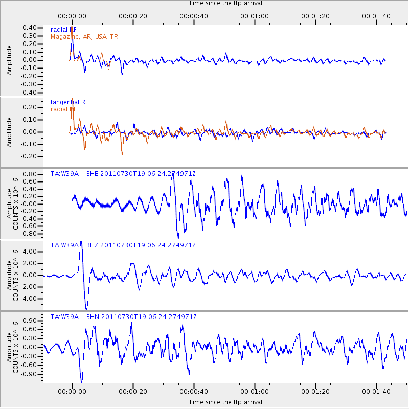
Signal To Noise
| Channel | StoN | STA | LTA |
| TA:W39A: :BHZ:20110730T19:06:24.274971Z | 35.885216 | 3.001649E-6 | 8.364584E-8 |
| TA:W39A: :BHN:20110730T19:06:24.274971Z | 5.814732 | 4.872318E-7 | 8.379264E-8 |
| TA:W39A: :BHE:20110730T19:06:24.274971Z | 4.393352 | 4.332027E-7 | 9.860414E-8 |
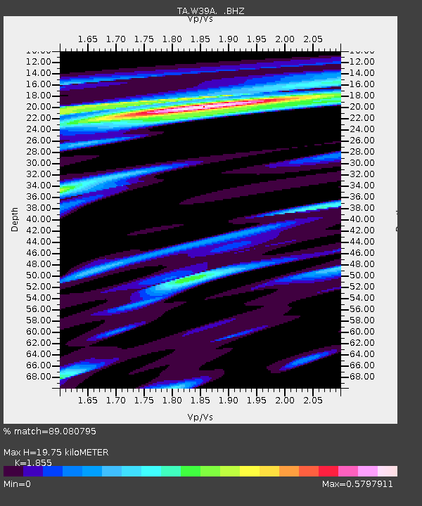
| Arrivals | |
| Ps | 2.7 SECOND |
| PpPs | 8.5 SECOND |
| PsPs/PpSs | 11 SECOND |

