S44A Carbondale, IL, USA - Earthquake Result Viewer
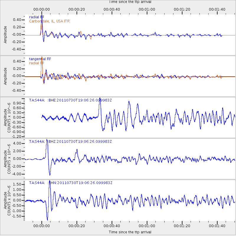
Earthquake location: Near East Coast Of Honshu, Japan
Earthquake latitude/longitude: 36.9/141.0
Earthquake time(UTC): 2011/07/30 (211) 18:53:49 GMT
Earthquake Depth: 30 km
Earthquake Magnitude: 6.4 MB, 6.0 MS, 6.5 MW, 6.4 MW
Earthquake Catalog/Contributor: WHDF/NEIC
Network: TA USArray Transportable Network (new EarthScope stations)
Station: S44A Carbondale, IL, USA
Lat/Lon: 37.69 N/89.26 W
Elevation: 155 m
Distance: 92.4 deg
Az: 37.599 deg
Baz: 321.961 deg
Ray Param: 0.041451424
Estimated Moho Depth: 11.75 km
Estimated Crust Vp/Vs: 2.10
Assumed Crust Vp: 6.444 km/s
Estimated Crust Vs: 3.072 km/s
Estimated Crust Poisson's Ratio: 0.35
Radial Match: 94.602585 %
Radial Bump: 328
Transverse Match: 90.06679 %
Transverse Bump: 400
SOD ConfigId: 408116
Insert Time: 2012-01-01 01:40:16.851 +0000
GWidth: 2.5
Max Bumps: 400
Tol: 0.001

Signal To Noise

ChannelStoNSTALTA
TA:S44A: :BHZ:20110730T19:06:26.099983Z25.0782832.417648E-69.640404E-8
TA:S44A: :BHN:20110730T19:06:26.099983Z15.8845648.860771E-75.578227E-8
TA:S44A: :BHE:20110730T19:06:26.099983Z4.3045535.249195E-71.2194518E-7
Arrivals
Ps2.0 SECOND
PpPs5.6 SECOND
PsPs/PpSs7.6 SECOND