
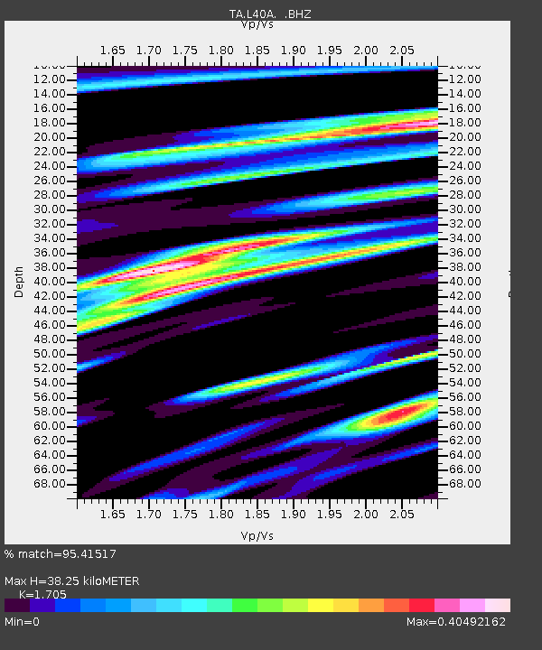
L40A Anamosa, IA, USA - Earthquake Result Viewer
| ||||||||||||||||||
| ||||||||||||||||||
| ||||||||||||||||||
|
Signal To Noise
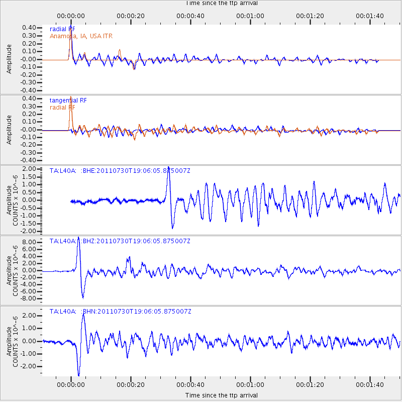
| Channel | StoN | STA | LTA |
| TA:L40A: :BHZ:20110730T19:06:05.875007Z | 63.54262 | 4.5667834E-6 | 7.1869614E-8 |
| TA:L40A: :BHN:20110730T19:06:05.875007Z | 15.492715 | 1.2972922E-6 | 8.373563E-8 |
| TA:L40A: :BHE:20110730T19:06:05.875007Z | 12.5869055 | 1.030106E-6 | 8.1839495E-8 |
| Arrivals | |
| Ps | 4.2 SECOND |
| PpPs | 15 SECOND |
| PsPs/PpSs | 20 SECOND |

