GNW Green Mountain (BB) - Earthquake Result Viewer
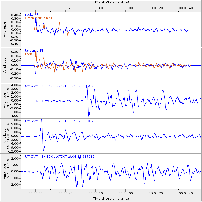
Earthquake location: Near East Coast Of Honshu, Japan
Earthquake latitude/longitude: 36.9/141.0
Earthquake time(UTC): 2011/07/30 (211) 18:53:49 GMT
Earthquake Depth: 30 km
Earthquake Magnitude: 6.4 MB, 6.0 MS, 6.5 MW, 6.4 MW
Earthquake Catalog/Contributor: WHDF/NEIC
Network: UW Pacific Northwest Regional Seismic Network
Station: GNW Green Mountain (BB)
Lat/Lon: 47.56 N/122.83 W
Elevation: 160 m
Distance: 67.6 deg
Az: 46.749 deg
Baz: 300.498 deg
Ray Param: 0.056827035
Estimated Moho Depth: 53.25 km
Estimated Crust Vp/Vs: 1.67
Assumed Crust Vp: 6.566 km/s
Estimated Crust Vs: 3.926 km/s
Estimated Crust Poisson's Ratio: 0.22
Radial Match: 93.58566 %
Radial Bump: 329
Transverse Match: 92.96628 %
Transverse Bump: 400
SOD ConfigId: 408116
Insert Time: 2012-01-01 01:42:38.285 +0000
GWidth: 2.5
Max Bumps: 400
Tol: 0.001

Signal To Noise

ChannelStoNSTALTA
UW:GNW: :BHZ:20110730T19:04:12.31501Z78.153814.8484535E-66.203732E-8
UW:GNW: :BHN:20110730T19:04:12.31501Z4.03594453.1921223E-77.909233E-8
UW:GNW: :BHE:20110730T19:04:12.31501Z19.926111.552132E-67.789438E-8
Arrivals
Ps5.7 SECOND
PpPs21 SECOND
PsPs/PpSs26 SECOND