
HEBO Mt. Hebo, OR CREST BB SMO - Earthquake Result Viewer
| ||||||||||||||||||
| ||||||||||||||||||
| ||||||||||||||||||
|
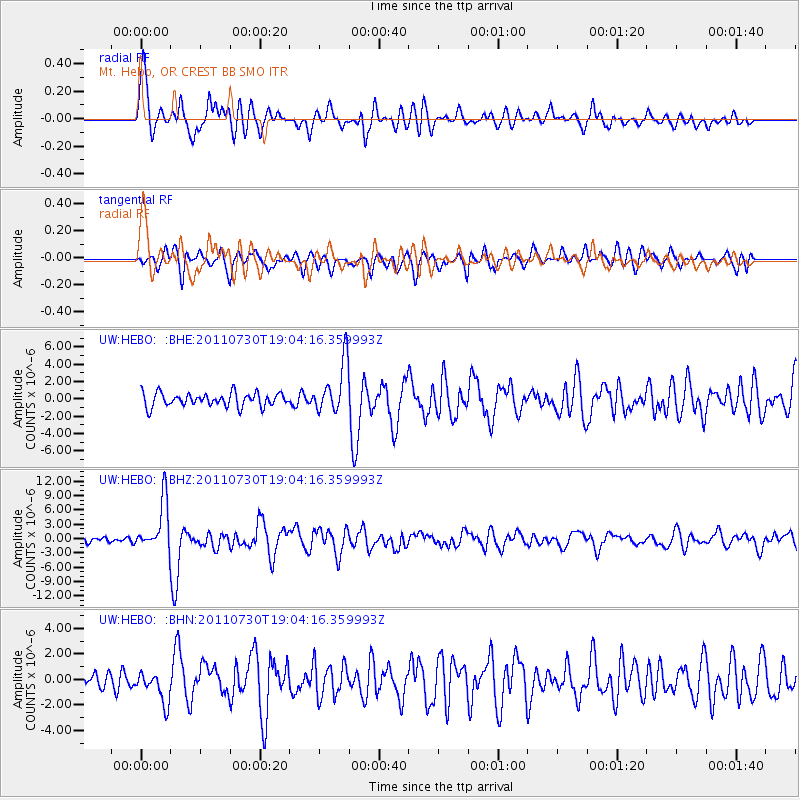
Signal To Noise
| Channel | StoN | STA | LTA |
| UW:HEBO: :BHZ:20110730T19:04:16.359993Z | 9.637935 | 5.221639E-6 | 5.4177985E-7 |
| UW:HEBO: :BHN:20110730T19:04:16.359993Z | 2.066613 | 1.2345229E-6 | 5.973653E-7 |
| UW:HEBO: :BHE:20110730T19:04:16.359993Z | 3.802179 | 2.9859395E-6 | 7.8532327E-7 |
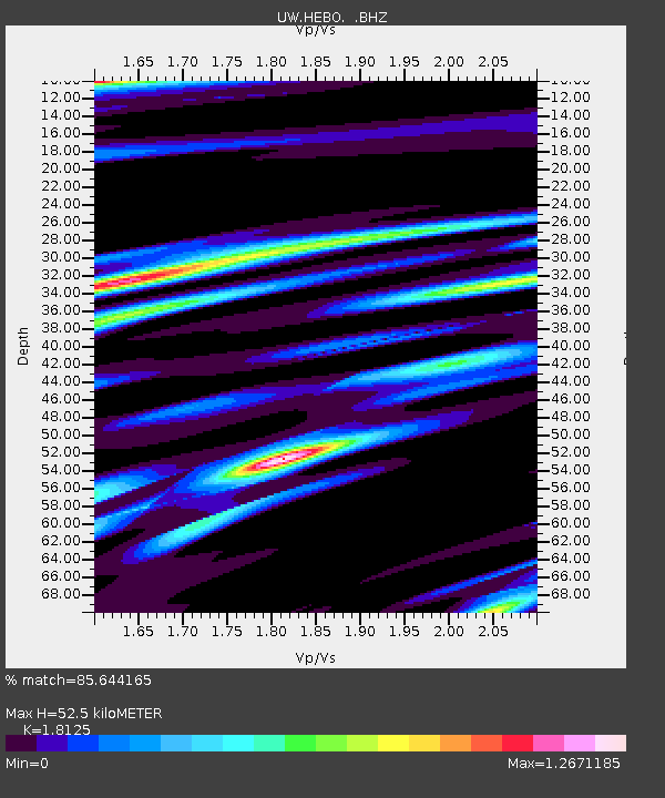
| Arrivals | |
| Ps | 6.8 SECOND |
| PpPs | 22 SECOND |
| PsPs/PpSs | 28 SECOND |

