
YACT Amboy, WA, USA - Earthquake Result Viewer
| ||||||||||||||||||
| ||||||||||||||||||
| ||||||||||||||||||
|
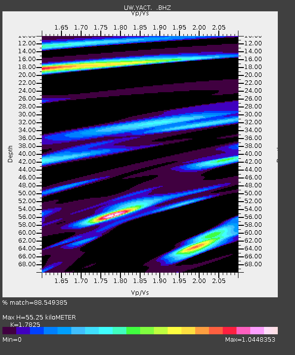
Signal To Noise
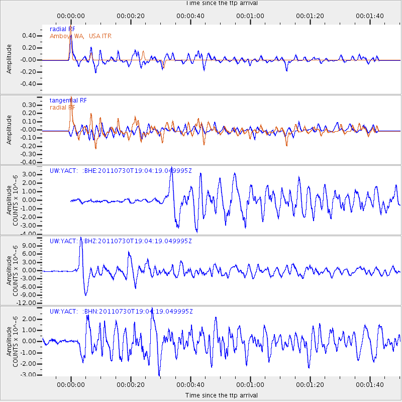
| Channel | StoN | STA | LTA |
| UW:YACT: :BHZ:20110730T19:04:19.049995Z | 34.124916 | 5.086377E-6 | 1.4905169E-7 |
| UW:YACT: :BHN:20110730T19:04:19.049995Z | 5.613637 | 7.2031764E-7 | 1.2831568E-7 |
| UW:YACT: :BHE:20110730T19:04:19.049995Z | 12.277098 | 1.5411888E-6 | 1.2553365E-7 |
| Arrivals | |
| Ps | 6.9 SECOND |
| PpPs | 22 SECOND |
| PsPs/PpSs | 29 SECOND |

