
STOR Enumclaw, WA, USA - Earthquake Result Viewer
| ||||||||||||||||||
| ||||||||||||||||||
| ||||||||||||||||||
|
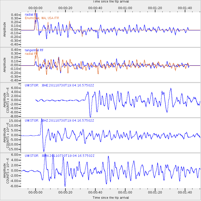
Signal To Noise
| Channel | StoN | STA | LTA |
| UW:STOR: :BHZ:20110730T19:04:16.57502Z | 43.082012 | 6.474217E-6 | 1.5027658E-7 |
| UW:STOR: :BHN:20110730T19:04:16.57502Z | 8.514152 | 1.2761118E-6 | 1.4988126E-7 |
| UW:STOR: :BHE:20110730T19:04:16.57502Z | 5.994635 | 1.2912479E-6 | 2.1540059E-7 |
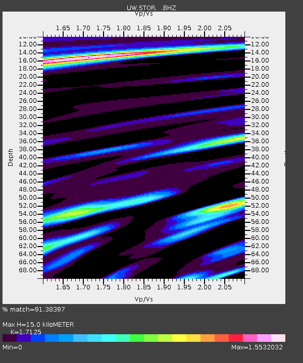
| Arrivals | |
| Ps | 1.7 SECOND |
| PpPs | 5.9 SECOND |
| PsPs/PpSs | 7.6 SECOND |

