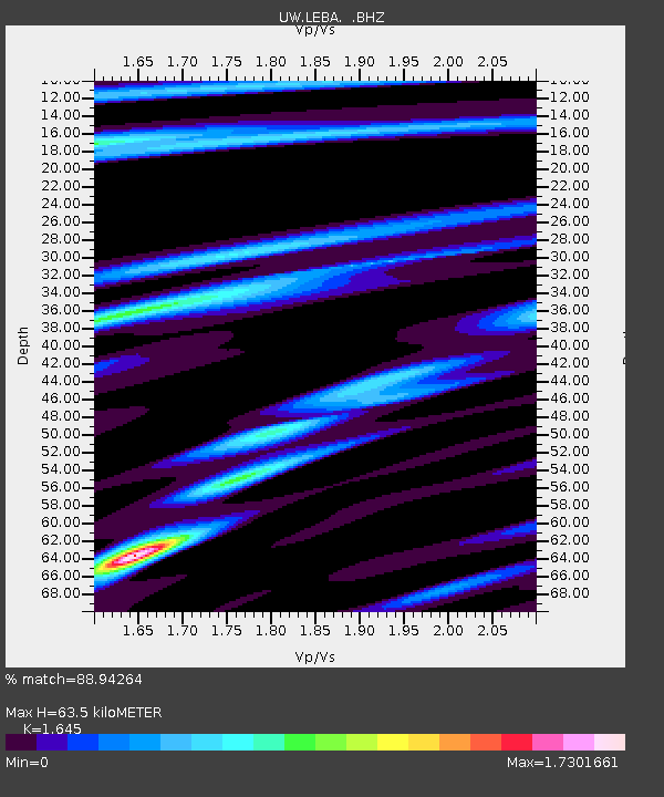
LEBA Lebam, WA, USA - Earthquake Result Viewer
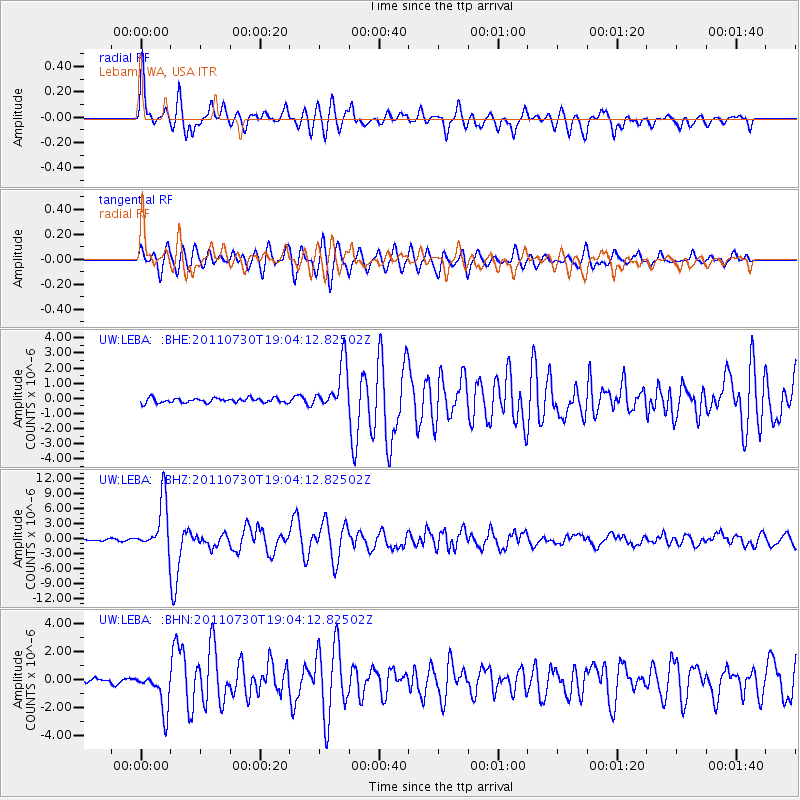
Earthquake location: Near East Coast Of Honshu, Japan
Earthquake latitude/longitude: 36.9/141.0
Earthquake time(UTC): 2011/07/30 (211) 18:53:49 GMT
Earthquake Depth: 30 km
Earthquake Magnitude: 6.4 MB, 6.0 MS, 6.5 MW, 6.4 MW
Earthquake Catalog/Contributor: WHDF/NEIC
Network: UW Pacific Northwest Regional Seismic Network
Station: LEBA Lebam, WA, USA
Lat/Lon: 46.55 N/123.56 W
Elevation: 73 m
Distance: 67.7 deg
Az: 47.975 deg
Baz: 300.426 deg
Ray Param: 0.056773845
Estimated Moho Depth: 63.5 km
Estimated Crust Vp/Vs: 1.64
Assumed Crust Vp: 6.566 km/s
Estimated Crust Vs: 3.992 km/s
Estimated Crust Poisson's Ratio: 0.21
Radial Match: 88.94264 %
Radial Bump: 400
Transverse Match: 82.73019 %
Transverse Bump: 400
SOD ConfigId: 408116
Insert Time: 2012-01-01 01:43:59.191 +0000
GWidth: 2.5
Max Bumps: 400
Tol: 0.001

Signal To Noise

ChannelStoNSTALTA
UW:LEBA: :BHZ:20110730T19:04:12.82502Z45.9369055.1627294E-61.123874E-7
UW:LEBA: :BHN:20110730T19:04:12.82502Z8.501151.3970723E-61.643392E-7
UW:LEBA: :BHE:20110730T19:04:12.82502Z10.1768741.5422006E-61.5153972E-7
Arrivals
Ps6.5 SECOND
PpPs24 SECOND
PsPs/PpSs31 SECOND