
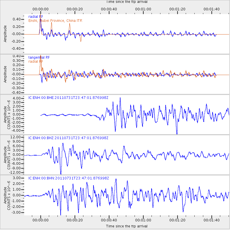
ENH Enshi, Hubei Province, China - Earthquake Result Viewer
| ||||||||||||||||||
| ||||||||||||||||||
| ||||||||||||||||||
|
Signal To Noise
| Channel | StoN | STA | LTA |
| IC:ENH:00:BHZ:20110731T23:47:01.876998Z | 14.692869 | 1.3653453E-6 | 9.29257E-8 |
| IC:ENH:00:BHN:20110731T23:47:01.876998Z | 4.3529325 | 3.065424E-7 | 7.042205E-8 |
| IC:ENH:00:BHE:20110731T23:47:01.876998Z | 4.9897156 | 4.676589E-7 | 9.372456E-8 |
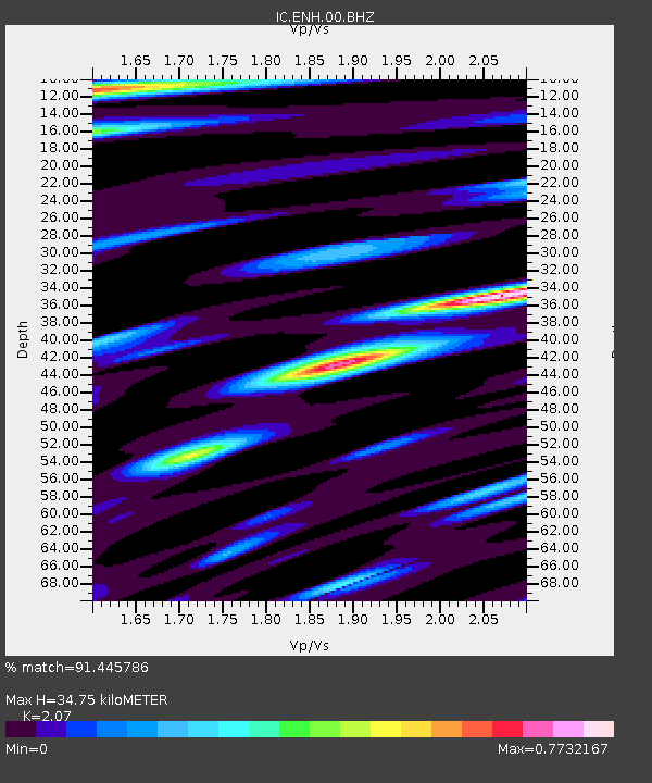
| Arrivals | |
| Ps | 6.4 SECOND |
| PpPs | 17 SECOND |
| PsPs/PpSs | 23 SECOND |

