You are here: Home > Network List > TA - USArray Transportable Network (new EarthScope stations) Stations List
> Station J05D Fort Rock, OR, USA > Earthquake Result Viewer
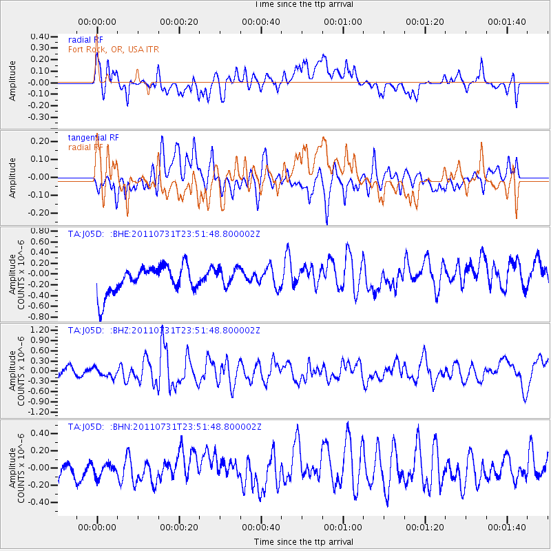
J05D Fort Rock, OR, USA - Earthquake Result Viewer
*The percent match for this event was below the threshold and hence no stack was calculated.
| Earthquake location: |
Near N Coast Of New Guinea, P.N.G. |
| Earthquake latitude/longitude: |
-3.5/144.8 |
| Earthquake time(UTC): |
2011/07/31 (212) 23:38:56 GMT |
| Earthquake Depth: |
10 km |
| Earthquake Magnitude: |
6.2 MB, 6.6 MS, 6.6 MW, 6.6 MW |
| Earthquake Catalog/Contributor: |
WHDF/NEIC |
|
| Network: |
TA USArray Transportable Network (new EarthScope stations) |
| Station: |
J05D Fort Rock, OR, USA |
| Lat/Lon: |
43.28 N/121.23 W |
| Elevation: |
1541 m |
|
| Distance: |
95.3 deg |
| Az: |
47.021 deg |
| Baz: |
270.133 deg |
| Ray Param: |
$rayparam |
*The percent match for this event was below the threshold and hence was not used in the summary stack. |
|
| Radial Match: |
62.683308 % |
| Radial Bump: |
400 |
| Transverse Match: |
62.315105 % |
| Transverse Bump: |
400 |
| SOD ConfigId: |
408116 |
| Insert Time: |
2012-01-01 02:17:09.853 +0000 |
| GWidth: |
2.5 |
| Max Bumps: |
400 |
| Tol: |
0.001 |
|
Signal To Noise
| Channel | StoN | STA | LTA |
| TA:J05D: :BHZ:20110731T23:51:48.800002Z | 1.3614739 | 1.3743283E-7 | 1.00944156E-7 |
| TA:J05D: :BHN:20110731T23:51:48.800002Z | 0.5335796 | 7.66603E-8 | 1.4367173E-7 |
| TA:J05D: :BHE:20110731T23:51:48.800002Z | 0.6747885 | 1.6960195E-7 | 2.513409E-7 |
| Arrivals |
| Ps | |
| PpPs | |
| PsPs/PpSs | |


