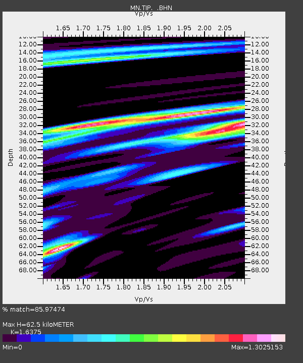
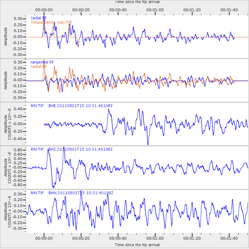
TIP Timpagrande, Italy - Earthquake Result Viewer

Earthquake location: Near S. Coast Of Honshu, Japan
Earthquake latitude/longitude: 34.6/138.4
Earthquake time(UTC): 2011/08/01 (213) 14:58:09 GMT
Earthquake Depth: 13 km
Earthquake Magnitude: 6.0 MB, 5.6 MS, 5.9 MW, 5.9 MW
Earthquake Catalog/Contributor: WHDF/NEIC
Network: MN MEDNET Project
Station: TIP Timpagrande, Italy
Lat/Lon: 39.18 N/16.76 E
Elevation: 789 m
Distance: 88.9 deg
Az: 318.579 deg
Baz: 44.58 deg
Ray Param: 0.042245608
Estimated Moho Depth: 62.5 km
Estimated Crust Vp/Vs: 1.64
Assumed Crust Vp: 6.1 km/s
Estimated Crust Vs: 3.725 km/s
Estimated Crust Poisson's Ratio: 0.20
Radial Match: 85.97474 %
Radial Bump: 400
Transverse Match: 74.68388 %
Transverse Bump: 400
SOD ConfigId: 408116
Insert Time: 2012-01-01 02:39:02.995 +0000
GWidth: 2.5
Max Bumps: 400
Tol: 0.001

Signal To Noise

ChannelStoNSTALTA
MN:TIP: :BHZ:20110801T15:10:31.40198Z9.507144.4695167E-74.7012215E-8
MN:TIP: :BHN:20110801T15:10:31.40198Z1.96013819.8419505E-85.0210495E-8
MN:TIP: :BHE:20110801T15:10:31.40198Z4.65618751.4364124E-73.0849538E-8
Arrivals
Ps6.7 SECOND
PpPs26 SECOND
PsPs/PpSs33 SECOND